2023 Map of Albion
USGS Topo · Published 2023About this map
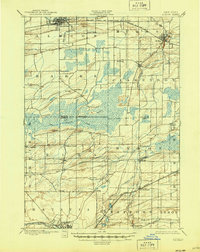
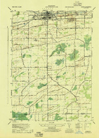
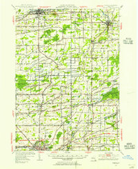
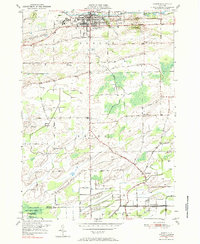
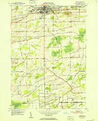
The Orleans County Courthouse stands as the historic centerpiece of Albion, where the landmark Erie Canal cuts through the northern landscape. This 2023 survey illustrates the enduring relationship between the village and its surrounding agricultural terrain, including the significant wetlands of the Oak Orchard Swamp and the drainage patterns of Manning Muckland Creek. The map provides substantial detail for genealogists and local historians, documenting several burial grounds such as Saint Josephs Cem, Mount Albion Cem, and the Barre Center Cem. Moving south from the canal, the settlement pattern shifts to smaller hamlets like Richs Corners and East Barre, linked by a grid of rural routes including Telegraph Rd and Lime Kiln RD. The presence of the Albion Reservoir Number Two and the meandering West Branch Sandy Creek further define the local topography.
Find a feature on this map
86 named features on this map. Tap any name to fly to it.
Don’t see what you’re looking for? This feature index may not catch every label — zoom into the map to look around manually.
Map Details
Editions of this 2023 Albion Map
This is the sole edition of this map. No revisions or reprints were ever made.
Historical Maps of Elba Through Time
6 maps found