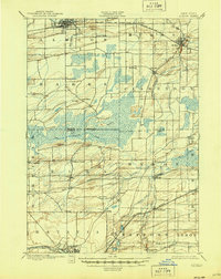
1897 Map of Albion
USGS Topo · Published 1945About this map
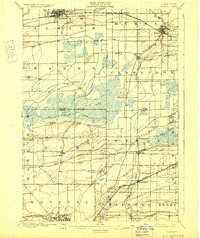
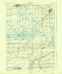
The Erie Canal anchors the northern reaches of this landscape, passing directly through Albion and near the village of Holley. This late nineteenth-century survey reveals a region defined by its transportation infrastructure and varied drainage patterns. While the canal dominates the north, the southern portion of the map is dominated by a dense network of steam transport, including the New York Central R.R., the West Shore R.R., and the Lehigh Valley R.R., which converge around the industrial hub of Batavia. Between these rail and water corridors lies the expansive Oak Orchard Swamp, a natural feature that constrained early settlement patterns in the center of the sheet. Smaller hamlets like South Byron, Elba, and Clarendon are documented at a time when local agriculture was transitioning from subsistence to a market economy facilitated by these new connections.
Find a feature on this map
49 named features on this map. Tap any name to fly to it.
Don’t see what you’re looking for? This feature index may not catch every label — zoom into the map to look around manually.
Map Details
Editions of this 1897 Albion Map
7 editions found
Other maps of this area

1897 · Albion
USGS Topo · 1:62,500

1897 · Medina
USGS Topo · 1:62,500

1897 · Oak Orchard
USGS Topo · 1:62,500

1897 · Ridgeway
USGS Topo · 1:62,500

1899 · Hamlin
USGS Topo · 1:62,500

1899 · Brockport
USGS Topo · 1:62,500

1904 · Batavia
USGS Topo · 1:62,500

1904 · Caledonia
USGS Topo · 1:62,500

1905 · Attica
USGS Topo · 1:62,500

1932 · Hamlin
USGS Topo · 1:24,000