2021 Map of Alcester
USGS Topo · Published 2021About this map
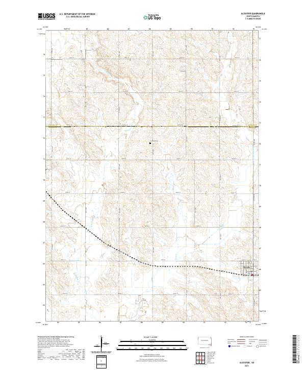
Alcester serves as the primary community anchor in this southeastern South Dakota landscape, situated along the boundary between Lincoln and Union counties. The town center features a concentrated grid including Iowa St, E 6th St, and a central Post Office, which has historically supported the surrounding agricultural trade. The terrain is defined by the winding paths of W Brule Cr and E Brule Cr, which converge to the south as the East Brule Creek. These waterways dictate the local drainage patterns and intersect the rigid section-line road network, such as 297th St and 475th Ave. Away from the town center, Gothland Cem remains a significant local landmark for genealogical research, marking the location of early settlers in this rural prairie region.
Find a feature on this map
28 named features on this map. Tap any name to fly to it.
Don’t see what you’re looking for? This feature index may not catch every label — zoom into the map to look around manually.
Map Details
Editions of this 2021 Alcester Map
This is the sole edition of this map. No revisions or reprints were ever made.
Historical Maps of Prairie Township Through Time
Featured Locations
- Norway Township, SD
- Pleasant Township, SD
- Prairie Township, SD
- Alcester Township, SD
- Alcester, Alcester Township