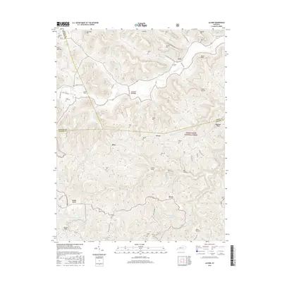
2016 Map of Alcorn
USGS Topo · Published 2016About this map
Alcorn and the surrounding high country of the Daniel Boone National Forest dominate this portrait of the borderlands between Jackson, Estill, and Madison Counties. The settlement pattern here is dictated by the narrow hollows and ridge lines, with small communities like Hisel, Brazil, and Locust Branch tucked along the headwaters of the South Fork Station Camp Creek. For family historians, the landscape is punctuated by numerous family burying grounds, including Skinner Cem, Isaacs Cem, and Hade-Rose Cem. The topography is particularly striking at Sinking Valley and the prominent Barker Point, while Turtle Rock serves as a distinctive local landmark near the Madison County line. Roadways like Chestnut Flat Rd and Happy Pappy Rd connect these remote knobs and flats, tracing the historical geography of this Appalachian interior.
Find a feature on this map
78 named features on this map. Tap any name to fly to it.
Don’t see what you’re looking for? This feature index may not catch every label — zoom into the map to look around manually.
Map Details
Editions of this 2016 Alcorn Map
This is the sole edition of this map. No revisions or reprints were ever made.
Other maps of this area

1891 · Manchester
USGS Topo · 1:125,000

1892 · Richmond
USGS Topo · 1:125,000

1892 · Beattyville
USGS Topo · 1:125,000

1893 · London
USGS Topo · 1:125,000

1897 · Richmond
USGS Topo · 1:125,000

1897 · London
USGS Topo · 1:125,000

1952 · Alcorn
USGS Topo · 1:24,000

1952 · Leighton
USGS Topo · 1:24,000

1952 · Irvine
USGS Topo · 1:24,000

1952 · Bighill
USGS Topo · 1:24,000