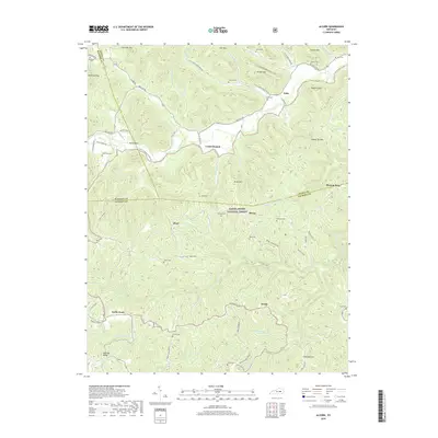
2019 Map of Alcorn
USGS Topo · Published 2019About this map
Locust Branch and the small community of Alcorn anchor this map of the Kentucky hills, situated where Madison, Estill, and Jackson Counties converge. The landscape is defined by the steep drainage basins of Red Lick Cr and the South Fork Station Camp Cr, which carve through heavily timbered ridges like Durham Ridge and Brooks Mtn. Numerous family cemeteries are tucked into these hollows, including Swine Cem, Barker Cem, and Skinner Cem, reflecting a long history of kinship and isolated settlement within the Daniel Boone National Forest. To the south, Kerby Knob and Brazil sit near the headwaters of Rock Lick Cr, while features like Sinking Valley and Big Hollow reveal the complex karst-influenced topography of the region. This 2019 survey captures a rural network of ridge roads and valley floor crossings that have shaped the local economy for generations.
Find a feature on this map
83 named features on this map. Tap any name to fly to it.
Don’t see what you’re looking for? This feature index may not catch every label — zoom into the map to look around manually.
Map Details
Editions of this 2019 Alcorn Map
This is the sole edition of this map. No revisions or reprints were ever made.
Other maps of this area

1891 · Manchester
USGS Topo · 1:125,000

1892 · Richmond
USGS Topo · 1:125,000

1892 · Beattyville
USGS Topo · 1:125,000

1893 · London
USGS Topo · 1:125,000

1897 · Richmond
USGS Topo · 1:125,000

1897 · London
USGS Topo · 1:125,000

1952 · Alcorn
USGS Topo · 1:24,000

1952 · Leighton
USGS Topo · 1:24,000

1952 · Irvine
USGS Topo · 1:24,000

1952 · Bighill
USGS Topo · 1:24,000