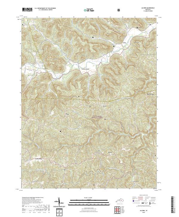
2022 Map of Alcorn
USGS Topo · Published 2022About this map
Daniel Boone National Forest encompasses a large portion of this area where Madison, Estill, and Jackson Counties meet. The landscape is characterized by complex ridge systems like Durham Ridge and isolated high points such as Happy Top Mtn and Zion Mtn. Small settlements are tucked into the valleys and gaps, including Locust Branch and Alcorn. The drainage network is dense, with Red Lick Cr and the South Fork Station Camp Creek carving through the terrain. For genealogists, the map is remarkably detailed, noting family-linked locations and numerous burial sites like Skinner Cem, Barker Cem, and Hade-Rose Cem along the winding hollow roads. These smaller landmarks, alongside features like Turtle Rock and Blanton Flats, provide a clear picture of the rural distribution of homesteads and communities in this part of Kentucky.
Find a feature on this map
79 named features on this map. Tap any name to fly to it.
Don’t see what you’re looking for? This feature index may not catch every label — zoom into the map to look around manually.
Map Details
Editions of this 2022 Alcorn Map
This is the sole edition of this map. No revisions or reprints were ever made.
Other maps of this area

1891 · Manchester
USGS Topo · 1:125,000

1892 · Richmond
USGS Topo · 1:125,000

1892 · Beattyville
USGS Topo · 1:125,000

1893 · London
USGS Topo · 1:125,000

1897 · Richmond
USGS Topo · 1:125,000

1897 · London
USGS Topo · 1:125,000

1952 · Alcorn
USGS Topo · 1:24,000

1952 · Leighton
USGS Topo · 1:24,000

1952 · Irvine
USGS Topo · 1:24,000

1952 · Bighill
USGS Topo · 1:24,000