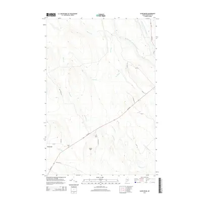
2014 Map of Alder Brook
USGS Topo · Published 2014About this map
Glenwood sits as a primary point of reference in this landscape of the Maine North Woods, where the terrain is defined by the convergence of several significant watercourses. The drainage of Alder Brook and Battle Brook feeds into the larger river systems, including the West Branch Mattawamkeag River and the East Branch Mattawamkeag River in the northeastern corner. The historic Military Rd cuts diagonally across the topography, a critical piece of infrastructure that predates modern highway systems. For those tracing local families, the map identifies specific burial sites like Twombly Cem and Eastman Cem, often the only remaining physical markers of nineteenth and early twentieth-century settlement. Elevated landforms such as Codfish Ridge overlook the numerous brooks, including Goniya Brook and Smith Brook, which weave through the forested interior.
Find a feature on this map
23 named features on this map. Tap any name to fly to it.
Don’t see what you’re looking for? This feature index may not catch every label — zoom into the map to look around manually.
Map Details
Editions of this 2014 Alder Brook Map
This is the sole edition of this map. No revisions or reprints were ever made.
Other maps of this area

1940 · Danforth
USGS Topo · 1:62,500

1940 · Amity
USGS Topo · 1:62,500

1941 · Danforth
USGS Topo · 1:62,500

1941 · Amity
USGS Topo · 1:62,500

1941 · Mattawamkeag Lake
USGS Topo · 1:62,500

1941 · Wytopitlock
USGS Topo · 1:62,500

1943 · Danforth
USGS Topo · 1:62,500

1943 · Wytopitlock
USGS Topo · 1:62,500

1943 · Amity
USGS Topo · 1:62,500

1943 · Mattawamkeag Lake
USGS Topo · 1:62,500