
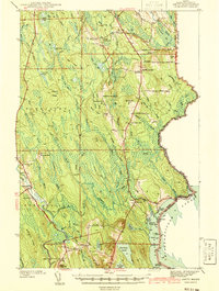
1941 Map of Amity
USGS Topo · Published 1941About this map
Wilcox Settlement and Estabrook Settlement anchor this 1941 survey of eastern Aroostook County, where the international boundary with New Brunswick is defined by the Chiputneticook Lakes and a series of monumented lines. The rural infrastructure of the late 1930s is meticulously documented, showing a high density of country schoolhouses such as Smith Sch, South Amity Sch, and No 9 Sch serving isolated farmsteads.
Find a feature on this map
64 named features on this map. Tap any name to fly to it.
Don’t see what you’re looking for? This feature index may not catch every label — zoom into the map to look around manually.
Map Details
Editions of this 1941 Amity Map
2 editions found
Other maps of this area

1937 · Smyrna Mills
USGS Topo · 1:62,500

1938 · Houlton
USGS Topo · 1:62,500

1940 · Danforth
USGS Topo · 1:62,500

1940 · Amity
USGS Topo · 1:62,500

1940 · Forest
USGS Topo · 1:62,500

1941 · Danforth
USGS Topo · 1:62,500

1941 · Mattawamkeag Lake
USGS Topo · 1:62,500

1941 · Wytopitlock
USGS Topo · 1:62,500

1942 · Forest
USGS Topo · 1:62,500

1943 · Danforth
USGS Topo · 1:62,500