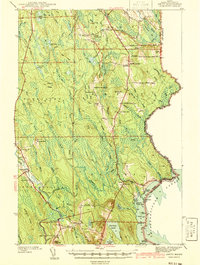
1941 Map of Amity
USGS Topo · Published 1941About this map
Wilcox Settlement and Estabrook Settlement anchor this 1941 survey of eastern Aroostook County, where family-named enclaves and small rural schools defined the community landscape. Situated along the international border with New Brunswick, the area is characterized by a dense network of watercourses including the Mattawamkeag River and South Branch Meduxnekeag River. The map captures a transition in local infrastructure, noting the Ferry Bridge near Selden and the presence of a Fire Tower atop Mitchell Mtn.
Find a feature on this map
88 named features on this map. Tap any name to fly to it.
Don’t see what you’re looking for? This feature index may not catch every label — zoom into the map to look around manually.
Map Details
Editions of this 1941 Amity Map
2 editions found
Other maps of this area

1937 · Smyrna Mills
USGS Topo · 1:62,500

1938 · Houlton
USGS Topo · 1:62,500

1940 · Danforth
USGS Topo · 1:62,500

1940 · Amity
USGS Topo · 1:62,500

1940 · Forest
USGS Topo · 1:62,500

1941 · Danforth
USGS Topo · 1:62,500

1941 · Amity
USGS Topo · 1:62,500

1941 · Mattawamkeag Lake
USGS Topo · 1:62,500

1941 · Wytopitlock
USGS Topo · 1:62,500

1942 · Forest
USGS Topo · 1:62,500