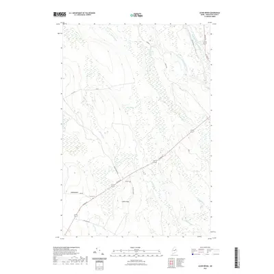
2021 Map of Alder Brook
USGS Topo · Published 2021About this map
Glenwood sits along the southern edge of this Aroostook County landscape, characterized by an intricate network of waterways and low ridges. The geography is defined by the confluence of the West Branch Mattawamkeag River and East Branch Mattawamkeag River in the northeast, while the central terrain is marked by Codfish Ridge. The area's settlement history is anchored by the Eastman Cem and Twombly Cem, both located near the primary transit route of Military Rd. Numerous smaller drainages such as Alder Brook, Battle Brook, and Gorilla Brook thread through the timberlands, illustrating the water-dependent nature of the local economy and land use. Several logging and local roads, including Yankee Woodshed Rd and Codfish Ridge Rd, provide access to these interior woodlands.
Find a feature on this map
22 named features on this map. Tap any name to fly to it.
Don’t see what you’re looking for? This feature index may not catch every label — zoom into the map to look around manually.
Map Details
Editions of this 2021 Alder Brook Map
This is the sole edition of this map. No revisions or reprints were ever made.
Other maps of this area

1940 · Danforth
USGS Topo · 1:62,500

1940 · Amity
USGS Topo · 1:62,500

1941 · Danforth
USGS Topo · 1:62,500

1941 · Amity
USGS Topo · 1:62,500

1941 · Mattawamkeag Lake
USGS Topo · 1:62,500

1941 · Wytopitlock
USGS Topo · 1:62,500

1943 · Danforth
USGS Topo · 1:62,500

1943 · Wytopitlock
USGS Topo · 1:62,500

1943 · Amity
USGS Topo · 1:62,500

1943 · Mattawamkeag Lake
USGS Topo · 1:62,500