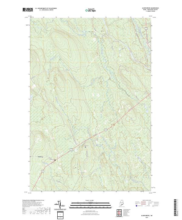
2024 Map of Alder Brook
USGS Topo · Published 2024About this map
The settlement of Glenwood anchors the southwestern corner of this landscape, where local life follows the historical corridor of the Military Rd. The map reveals a heavily forested terrain defined by a complex network of waterways, including the East Branch Mattawamkeag River and West Branch Mattawamkeag River in the northeast. Family history and local heritage are preserved in rural burial sites like the Twombly Cem and Eastman Cem, which sit near the intersection of the primary road and Codfish Ridge Rd. Rising above the surrounding wetlands and drainage basins of Alder Brook and Gony Brook, the prominent Codfish Ridge provides a topographical spine for the southern half of the quadrangle. The map reflects a region where the logging and transit routes, such as Yankee Woodshed Rd and Baskhegan Rd, have long shaped the human footprint in the Maine woods.
Find a feature on this map
24 named features on this map. Tap any name to fly to it.
Don’t see what you’re looking for? This feature index may not catch every label — zoom into the map to look around manually.
Map Details
Editions of this 2024 Alder Brook Map
This is the sole edition of this map. No revisions or reprints were ever made.
Other maps of this area

1940 · Danforth
USGS Topo · 1:62,500

1940 · Amity
USGS Topo · 1:62,500

1941 · Danforth
USGS Topo · 1:62,500

1941 · Amity
USGS Topo · 1:62,500

1941 · Mattawamkeag Lake
USGS Topo · 1:62,500

1941 · Wytopitlock
USGS Topo · 1:62,500

1943 · Danforth
USGS Topo · 1:62,500

1943 · Wytopitlock
USGS Topo · 1:62,500

1943 · Amity
USGS Topo · 1:62,500

1943 · Mattawamkeag Lake
USGS Topo · 1:62,500