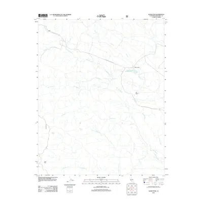
2012 Map of Alder Peak
USGS Topo · Published 2012About this map
San Miguelito Ranch sits near the eastern edge of this coastal range landscape, where the Nacimiento River carves a winding path toward the south. The drainage network is complex, defined by numerous seasonal tributaries like Slickrock Cr, San Miguel Cr, and Anthony Cr that feed into the larger river valley. In the north, Stony Valley provides a rare area of lower relief, anchored by the Lower Stony Creek Reservoir. High points like Alder Peak dominate the southern portion of the sheet, surrounded by a network of water sources including Squirrel Spring, Sycamore Spring, and Round Spring. The primary access through this remote terrain is via the Nacimiento-Fergusson Rd and Monterey Co Route 4004, which provide critical transit across the steep canyons and ridges of the Santa Lucia Range.
Find a feature on this map
19 named features on this map. Tap any name to fly to it.
Don’t see what you’re looking for? This feature index may not catch every label — zoom into the map to look around manually.
Map Details
Editions of this 2012 Alder Peak Map
This is the sole edition of this map. No revisions or reprints were ever made.
Other maps of this area

1919 · King City
USGS Topo · 1:62,500

1919 · Junipero Serra
USGS Topo · 1:62,500

1919 · Bryson
USGS Topo · 1:62,500

1921 · Cape San Martin
USGS Topo · 1:62,500

1939 · King City
USGS Topo · 1:62,500

1941 · Cape San Martin
USGS Topo · 1:62,500

1941 · Junipero Serra
USGS Topo · 1:62,500

1941 · Bryson
USGS Topo · 1:62,500

1942 · Bryson
USGS Topo · 1:62,500

1942 · Cape San Martin
USGS Topo · 1:62,500