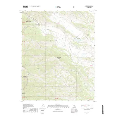
2018 Map of Alder Peak
USGS Topo · Published 2018About this map
Santa Lucia Range peaks and deep canyons define this terrain within the Los Padres National Forest. Much of the central and eastern landscape is occupied by the Fort Hunter Liggett military reservation, where the Nacimiento River flows toward the Lower Stoney Cr Reservoir near the settlement of Stony Valley. The map detail traces an intricate network of drainage systems, including Slickrock Cr and Los Burros Cr, which carve through the high elevations surrounding Alder Peak.
Find a feature on this map
31 named features on this map. Tap any name to fly to it.
Don’t see what you’re looking for? This feature index may not catch every label — zoom into the map to look around manually.
Map Details
Editions of this 2018 Alder Peak Map
This is the sole edition of this map. No revisions or reprints were ever made.
Other maps of this area

1919 · King City
USGS Topo · 1:62,500

1919 · Junipero Serra
USGS Topo · 1:62,500

1919 · Bryson
USGS Topo · 1:62,500

1921 · Cape San Martin
USGS Topo · 1:62,500

1939 · King City
USGS Topo · 1:62,500

1941 · Cape San Martin
USGS Topo · 1:62,500

1941 · Junipero Serra
USGS Topo · 1:62,500

1941 · Bryson
USGS Topo · 1:62,500

1942 · Bryson
USGS Topo · 1:62,500

1942 · Cape San Martin
USGS Topo · 1:62,500