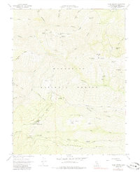
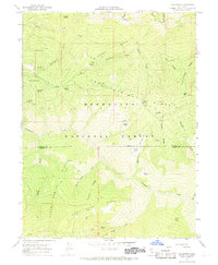
1967 Map of Alder Springs
USGS Topo · Published 1985About this map
Mendocino National Forest defines this high-elevation landscape in Glenn County, where the topography is shaped by a dense network of ridges and canyons. The settlement at Alder Springs and nearby Camp Ellendale serve as primary points of interest in a region largely dominated by forestry and seasonal water sources. The map documents an intricate system of backcountry access, from the Kilgore Jeep Trail to various unnamed pack trails that connect remote landmarks like Fiddlers Green and the Hardin Hole depression.
Find a feature on this map
43 named features on this map. Tap any name to fly to it.
Don’t see what you’re looking for? This feature index may not catch every label — zoom into the map to look around manually.
Map Details
Editions of this 1967 Alder Springs Map
3 editions found
Other maps of this area

1919 · Elk Creek
USGS Topo · 1:62,500

1948 · Elk Creek
USGS Topo · 1:62,500

1952 · Paskenta
USGS Topo · 1:62,500

1952 · Hull Mountain
USGS Topo · 1:62,500

1952 · Anthony Peak
USGS Topo · 1:62,500

1957 · Elk Creek
USGS Topo · 1:62,500

1957 · Ukiah
USGS Topo · 1:250,000

1960 · Ukiah
USGS Topo · 1:250,000
1967 · Plaskett meadows
USGS Topo · 1:24,000
1967 · Log Spring
USGS Topo · 1:24,000