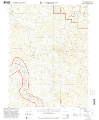
2022 Map of Alderpoint
USGS Topo · Published 2022About this map
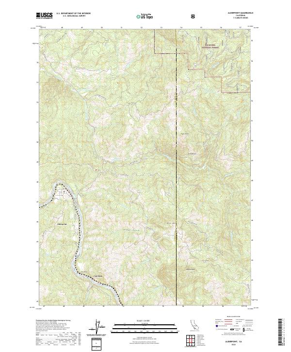
Alderpoint sits at a critical bend in the Eel Wild and Scenic River, where the canyon walls and winding tributaries define the remote geography of the Emerald Triangle. The landscape transition is evident at Cain Rock, where the river valley widens slightly before continuing its northward course toward the Pacific. The area’s rugged interior is marked by high elevations such as Wool Mtn and Neafus Peak, while the northeast corner of the sheet reaches into the Six Rivers National Forest near Graham Lake.
Find a feature on this map
45 named features on this map. Tap any name to fly to it.
Don’t see what you’re looking for? This feature index may not catch every label — zoom into the map to look around manually.
Map Details
Editions of this 2022 Alderpoint Map
This is the sole edition of this map. No revisions or reprints were ever made.
Historical Maps of Alderpoint Through Time
5 maps found