Old Maps of Trinity County, California
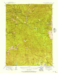
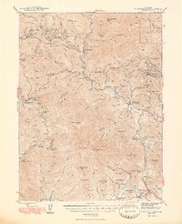
Explore 567 old maps of Trinity County, spanning from 1886 to today. These high-resolution historic maps reveal how streets, neighborhoods, landmarks, and natural features evolved over time — perfect for genealogy, metal detecting, research, and local history exploration.
What you can do with these maps:
- See how Trinity County changed over time: Compare historical maps to modern-day views to trace roads, homesites, rail lines & more.
- View detailed metadata: Each map includes creators, publishers, year, scale, and archive source.
- Overlay maps with satellite & LiDAR: Visualize the past alongside modern tools to explore terrain & human change.
- Trusted historical sources: Maps sourced from the USGS, Library of Congress, and other archives.
- Access maps your way: View online, download high-res files, or order prints for personal or research use.
Start exploring old maps of Trinity County to uncover forgotten places, hidden landmarks, and the deep history beneath your feet.
Trinity County, CA maps
(567)- 1886 Map of Shasta
 1886 Shasta1886 Print · USGSUpper California in the mid-1880s is captured here during the height of the mining era and the early days of mountain tourism. Genealogists can locate family holdings near Yreka, trace river crossings like the ferry at Oaks Bar, or find early resorts at Upper Soda Spring.3 unique versions available
 - 1890 Map of Red Bluff
 1890 Red Bluff1890 Print · USGSNorthern California in the late nineteenth century was a hub of river-and-rail activity where the Central Pacific Railroad met the rugged Klamath Mountains. Researchers can trace old ferry crossings like Ball's Ferry, locate the U.S. Fishery, or find early mining camps and stations such as Minersville and Buck Horn Station.
 - 1894 Map of Red Bluff, 1896 Print
 1894 Red Bluff1896 Print · USGSNorthern California's mining and river-trading frontier comes alive in this survey of the late nineteenth century. Genealogists and historians can trace the growth of rail hubs like Redding or locate early river crossings and industrial sites such as Jelley's Ferry and the Copper Mine.6 unique versions available
 - 1894 Map of Shasta, 1903 Print
 1894 Shasta1903 Print · USGSNorthern California at the turn of the century reveals a landscape defined by the shadow of Mt Shasta and a booming mining economy. Genealogists can trace family roots through pioneer settlements like Yreka, Fort Jones, and the Callahan Ranch as the frontier transitioned into a network of established ranching and timber hubs.8 unique versions available
 - 1909 Map of Big Bar
 1909 Big Bar1909 Print · USGSTrinity County at the turn of the century shows a land defined by deep river canyons and remote mountain settlements. Genealogists and local historians can trace early footprints at Hyampom and Hayfork, or locate the high ridges of Barker Mtn and Thompson Peak.2 unique versions available
 - 1913 Map of Weaverville
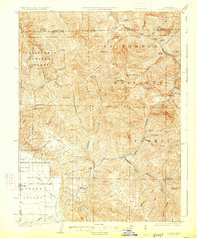
 1913 Weaverville1913 Print · USGSTrinity and Shasta counties appear here during a peak era of mountain mining and ranching before the mid-century reservoirs were built. Genealogists can trace early homesteads and industrial sites like Whiskytown, Minersville, and the Gladstone Mine.6 unique versions available
 - 1914 Map of Pilot Creek
 1914 Pilot Creek1914 Print · USGSHumboldt and Trinity counties are shown during the early years of the national forest system, before modern road networks penetrated these deep woods. Researchers can trace early infrastructure like Wises Substation and Oak Park R.S. or locate remote landmarks like Durphys Lake.
 - 1915 Map of Big Bar and Vicinity
 1915 Big Bar and Vicinity1915 Print · USGSThe Trinity River wilderness in the early twentieth century was a landscape of isolated mining outposts and river settlements. Genealogists and historians can trace the early footprints of Junction City, Helena, and Hyampom alongside remote landmarks like Keystone Cabin.5 unique versions available
 - 1918 Map of Anada, 1931 Print
 1918 Anada1931 Print · USGSTrinity County in the early twentieth century was a rugged frontier of forest management and river headwaters. Map collectors and genealogists can trace early landmarks like Ruth, the Mad River R.S., and the high elevations of South Fork Mountain.
 - 1920 Map of Cummings
 1920 Cummings1920 Print · USGSMendocino County ranching and transit corridors are captured in the years following the Great War as the modern highway began to take shape. Genealogists and historians can locate family holdings like Buckhorn Ranch and Spittler Ranch alongside early settlements at Bell Springs and Cummings.
 - 1920 Map of Covelo
 1920 Covelo1920 Print · USGSTracing the Eel River in the early twentieth century, this military survey reveals the remote homesteads and rail infrastructure of Mendocino County. Genealogists can locate family-named sites like Fred Simmerly Sr and Nash along the Northwestern Pacific Railroad.
 - 1920 Map of Harris
 1920 Harris1920 Print · USGSHumboldt County ranching and rail life are recorded here during the early twentieth century as the railroad carved its path through the Eel River canyon. Researchers can trace historic family holdings like Carey Ranch or locate early industrial sites such as the Steelhead US Fish Hatchery and Fort Seward.
 - 1921 Map of Hoaglin, 1922 Print
 1921 Hoaglin1922 Print · USGSTrinity County in the early twenties shows a wilderness being mapped for forest management and rail access. Genealogists and researchers can trace early ranger outposts like Soldier Basin R.s. and follow the Northwestern Pacific RR near Island Mountain.
 - 1922 Map of Island Mountain
 1922 Island Mountain1922 Print · USGSNorthern California forest lands and river canyons are detailed in this early twenties tactical survey. Genealogists and researchers can locate remote outposts like Zenia and Hoaglin, or trace the rugged banks of the Mad River and Eel River.
 - 1922 Map of China Flat
 1922 China Flat1922 Print · USGSNorthwestern California at the dawn of the 1920s reveals a landscape of isolated river settlements and early forest service outposts. Genealogists and historians can trace the residents of Quinby and Uptons or locate the China Flat Post Office and Handy Horse Ranger Station.
 - 1923 Map of Sawyers Bar
 1923 Sawyers Bar1923 Print · USGSThe Salmon River canyon in the early 1900s reveals a high-country mining landscape during the height of its activity. Genealogists and historians can trace families at Edie Ranch, locate remote classrooms like Russianville School, and find numerous prospects including the Black Bear Mine.4 unique versions available
 - 1926 Map of Covelo
 1926 Covelo1926 Print · USGSThe isolated high valley of Covelo is captured here in the mid-1920s, surrounded by the wilderness of the California National Forest. Local historians can locate the Indian School, early ranger outposts, and family landmarks like Browns Ranch.2 unique versions available
 - 1931 Map of Hoaglin
 1931 Hoaglin1931 Print · USGSThe Trinity and Van Duzen river systems define this high country during the early 1930s, when remote ranches and forest stations provided the primary human footprint. Researchers can trace family-named sites like Haine Ranch and Blossom Cabin, or locate the isolated Lake Mtn Sch.
 - 1931 Map of Etna
 1931 Etna1931 Print · USGSThe mining camps and river valleys of the Siskiyou-Trinity border are caught in detail during the early 1930s. Researchers can trace historic claims and remote family holdings like the Bonanza King Mine, Etna Ranch, and the East Fork District Sch.
 - 1934 Map of Etna
 1934 Etna1934 Print · USGSThe Scott Valley and high California peaks are seen here in the 1930s as centers of mining and remote mountain ranching. Researchers can trace historic family-named locations such as Parker Ranch, Stoddard Cabin, and the Zarina Mine.4 unique versions available
 - 1935 Map of Hoaglin
 1935 Hoaglin1935 Print · USGSTrinity and Mendocino counties are captured here in the mid-1930s, documenting a landscape of isolated valleys and mountain ranches. Researchers can trace family homesteads like Russ Place and Shannon Place or locate early schools including Cover Sch and Lake Mtn Sch.3 unique versions available
 - 1935 Map of Dunsmuir
 1935 Dunsmuir1935 Print · USGSUpper Siskiyou and Shasta counties are shown here in the mid-1930s as the rail and timber industries shaped the mountain landscape. Genealogists and historians can trace the Southern Pacific line through Dunsmuir, locate the Cedar Park Sch, or find vanished stops like Sims Sta.4 unique versions available
 - 1944 Map of French Gulch, 1957 Print
 1944 French Gulch1957 Print · USGSThe mining districts of Shasta and Trinity counties are captured here in the mid-1940s, showcasing a landscape defined by gold extraction and rugged mountain summits. Researchers can trace historic claims and camps like French Gulch, the Brown Bear Mine, and the original site of Whiskeytown.2 unique versions available
 - 1948 Map of French Gulch
 1948 French Gulch1948 Print · USGSShasta and Trinity counties are shown here in the late 1940s, capturing the region's deep mining heritage and rugged summit peaks. Genealogists and historians can locate vanished mining camps and landmarks like Deadwood, the Niagara Mine, and Whiskeytown.2 unique versions available
 - 1948 Map of Weed, 1950 Print
 1948 Weed1950 Print · USGSNorthern California and Southern Oregon are captured here during the post-war era, documenting the mountain-and-valley economies of the Klamath and Cascade ranges. Trace the legacy of local mining and timber at the King Solomon Mine, find old schools like Siskiyou County School, and follow the historic Southern Pacific RR route.2 unique versions available
Showing maps 1-25 of 567
Top cities of Trinity County
- Weaverville historical maps
- Hayfork historical maps
- Lewiston historical maps
- Trinity Village historical maps
- Ruth historical maps
- Zenia historical maps
Frequently asked questions
- What are the different types of historical maps available for Trinity County?
- What is the oldest map of Trinity County?
- Where can I purchase historical maps of Trinity County for my home or office?
- Where can I download high-res historical maps of Trinity County?
- Are there historical topographic maps available for Trinity County?
- Is there historical aerial imagery available for Trinity County?
- Where are historical maps of Trinity County sourced from?