1980s Maps of Trinity County, California
Explore 53 historic maps of Trinity County from the 1980s. These maps offer a rare glimpse into what life looked like during the 1980s — showing old roads, neighborhoods, homes, and landmarks that have changed or disappeared over time.
Whether you're researching your family's past, planning a metal detecting trip, or studying how Trinity County's landscape evolved across the 1980s, these high-resolution maps are a powerful tool for exploring the history of this region.
- Focus on a specific era: All maps on this page are from the 1980s, giving you a focused view of this time period.
- See what’s changed: Compare century-old streets, trails, and buildings to today's modern landscape using overlays and satellite layers.
- Research with precision: Use these maps for genealogy, historical research, land use analysis, or educational projects.
- View, download, or print: Maps are fully viewable online in high resolution, and can be downloaded or printed for your own records.
Start exploring Trinity County's history through authentic maps from the 1980s. This is your window into the past.
Trinity County, CA maps
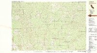
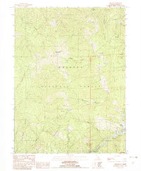
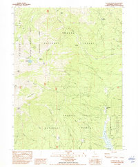
(53)- 1981 Map of North Yolla Bolly
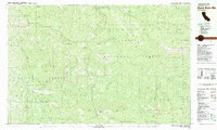
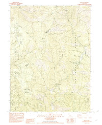
 1981 North Yolla Bolly1981 Print · USGSHigh-country ridges and wilderness basins dominate this corner of the Trinity and Mendocino forests in the early eighties. Researchers can locate remote outposts like the Saddle Camp Forest Service Station, the Tomhead Mine, and the Weston Ranch.
 - 1981 Map of Black Rock Mtn
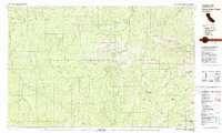
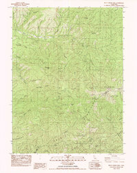
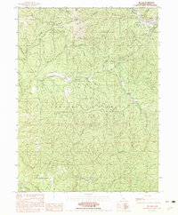
 1981 Black Rock Mtn1981 Print · USGSTrinity County's high-country terrain is documented here in the early eighties, where national forest boundaries and wilderness areas meet. Researchers can pinpoint old mining sites like the Bonanza Mine, landforms like Tombstone Rock, and the remote Black Rock Lake.
 - 1981 Map of Beegum
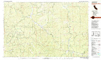
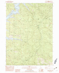
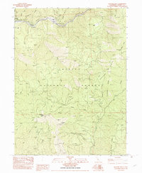
 1981 Beegum1981 Print · USGSThe remote borderlands of Tehama, Shasta, and Trinity counties are captured in the early eighties as a landscape of isolated ranching and federal forestry. Researchers can trace family-named sites like Williams Ranch, find the local Cem, or locate the Chrome Mine (Site).
 - 1981 Map of Pony Buck Peak
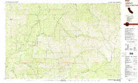
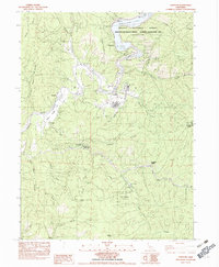
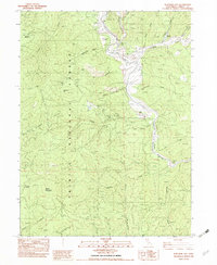
 1981 Pony Buck Peak1981 Print · USGSThe high country of the Trinity Mountains is captured here in the early 1980s, documenting a remote landscape of national forest lands and isolated family homesteads. Researchers can trace historic mountain sites like Murphy Place, explore mining legacy at Spider Mine, and locate features like Hell to Find Lake.
 - 1981 Map of Covelo
 1981 Covelo1981 Print · USGSIn the early 1980s, Mendocino County's interior and coastline remained a patchwork of tribal lands and timber outposts. Trace the Northwestern Pacific rail line and discover the boundaries of the Round Valley Indian Reservation Boundary and Covelo.2 unique versions available
 - 1981 Map of Dubakella Mtn
 1981 Dubakella Mtn1981 Print · USGSThe Trinity and Shasta County borderlands are mapped here in the early 1980s, showcasing a network of forest roads and remote settlements. Researchers can locate the Wildwood Sch, trace the Blue Point Ditch, and find the Shiell Ranch (Site).2 unique versions available
 - 1981 Map of Chanchelulla Peak
 1981 Chanchelulla Peak1981 Print · USGSThe Trinity and Shasta county line area in the early eighties was a landscape of high-altitude lookouts and deep-canyon ranching. Researchers can trace historic mining operations at Midas Mine or locate family sites like Williams Ranch and the Deer Lick Springs resort.2 unique versions available
 - 1981 Map of Four Corners Rock, 1982 Print
 1981 Four Corners Rock1982 Print · USGSTrinity County's high wilderness is documented here in the early eighties, where national forest boundaries meet along the Eel River. Researchers can trace remote sites like Travis Ranch, the Blue Jay Mine (Site), and the Indian Dick FS Station.2 unique versions available
 - 1981 Map of South Yolla Bolly, 1982 Print
 1981 South Yolla Bolly1982 Print · USGSThe high Coast Range crest comes into focus during the early 1980s, tracing the wild headwaters of the Eel and Thomes Creek. Researchers can locate remote high-country outposts like Lazyman Camp, Johnson Hdqrs, and the summit of South Yolla Bolly.
 - 1982 Map of Mt. Hilton
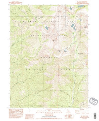 1982 Mt. Hilton1982 Print · USGSHigh in the Trinity Alps during the early eighties, this area remained a landscape of alpine lakes and scattered mining claims. You can trace the routes to the Alaska Mine, locate the Stonehouse (Site), and find backcountry camps like McKay Camp.2 unique versions available
 - 1982 Map of Weaverville
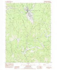 1982 Weaverville1982 Print · USGSTrinity County's gold-mining legacy is on full display here in the early 1980s, from the hydraulic scars of the La Grange Mine to the banks of the Trinity River. Genealogists and historians can trace old sites like Readings Bar and the Union Hill Mine.
 - 1982 Map of Jim Jam Ridge
 1982 Jim Jam Ridge1982 Print · USGSHigh in the Trinity mountains during the early eighties, this survey captures a landscape of seasonal hunting camps and remote forest outposts. You can trace early access routes to Miller Ranch, find water sources like Jim Jam Spring, and locate historic sites such as Jakes Hunting Ground and Hailstone Camp.
 - 1982 Map of Denny
 1982 Denny1982 Print · USGSTrinity County's remote mountain backcountry is captured here in the early 1980s at the intersection of two national forests. Genealogists and historians can locate mining roots at the Index Mine or trace former outposts like Elk Camp (Site) and the settlement of Hoboken.
 - 1982 Map of Bully Choop Mtn
 1982 Bully Choop Mtn1982 Print · USGSThe Trinity Mountains gold and copper country is captured here in the early eighties. Researchers can trace historical mining operations at Bully Choop Mine and Cleveland Mine, or follow the old Jerusalem Trail.
 - 1982 Map of Papoose Creek
 1982 Papoose Creek1982 Print · USGSThe Trinity Mountains and the shores of Clair Engle Lake are captured here in the early eighties as a hub of forest management and mountain recreation. Researchers can trace the winding Jeep Trails and locate old mountain outposts like the Five Pines Mine and the Trinity Mountain Forest Service Station.
 - 1982 Map of Lewiston
 1982 Lewiston1982 Print · USGSTrinity County in the early eighties shows a landscape of river-valley ranching and state forestry. Researchers can trace historic riverside locations like Lowden Ranch, the operations at French Mine, and the old crossroads at Buckhorn Station.2 unique versions available
 - 1982 Map of Helena
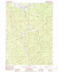
 1982 Helena1982 Print · USGSTrinity County’s gold and ranching history is preserved in this early 1980s survey of the river forks and mountain ridges. Researchers can locate former settlements at Coleridge (Site) and Long Ranch (Site) or trace mining operations like the Yellowstone Mine.
 - 1982 Map of Big Bar
 1982 Big Bar1982 Print · USGSThe Trinity River canyon and its surrounding peaks are captured in the early eighties as a rugged landscape of isolated settlements and forest trails. Researchers can trace the local landmarks like Pattison Peak, the small Cem near Big Bar, and old mining sites like the Prospect.2 unique versions available
 - 1982 Map of Hayfork Bally
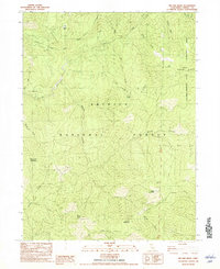
 1982 Hayfork Bally1982 Print · USGSTrinity County's high ridges and river canyons are captured here in the early 1980s, centered on the Trinity National Forest. Researchers can locate the Hayfork Bally Lookout and trace old resource sites like the Kottmeier Mine and Rose Ranch.2 unique versions available
 - 1982 Map of Junction City
 1982 Junction City1982 Print · USGSJunction City and the Trinity River valley are captured in the early 1980s, showcasing a landscape shaped by decades of gold mining. Genealogists and historians can trace family-named sites like Carter Ranch and Benjamin Flat or locate the Bit Mine.
 - 1982 Map of Covington Mill
 1982 Covington Mill1982 Print · USGSThe Trinity Alps and the upper reaches of the Clair Engle reservoir define this area in the early eighties. Local historians can trace the sites of Covington Mill and the Heath Ranch, or locate the Hydraulic Mine and high-country meadows like Preacher Meadow.
 - 1982 Map of Halfway Ridge
 1982 Halfway Ridge1982 Print · USGSTrinity County's high forest ridges and hidden valleys are captured here during the late twentieth century. Researchers can trace the water sources and small-scale operations of the era, from Indian Valley Station to localized sites like a Mine and Butter Creek Meadows.2 unique versions available
 - 1982 Map of Damnation Peak
 1982 Damnation Peak1982 Print · USGSIn the early eighties, this pocket of the Trinity Mountains preserved traces of its industrial and ranching past. You can trace old transit routes past the Tollhouse or locate the historic Lamoine Mill (Site) and Caves Mine.
 - 1982 Map of Dedrick
 1982 Dedrick1982 Print · USGSTrinity County's gold-mining legacy is preserved in this early 1980s survey of the rugged Canyon Creek drainage. Researchers can trace the location of historical workings like Enterprise Mine and lost camps such as Canyon City or Dedrick.
 - 1982 Map of Hyampom
 1982 Hyampom1982 Print · USGSHyampom and the surrounding Trinity National Forest are shown here in the early eighties at the confluence of the South Fork Trinity River and Hayfork Creek. Researchers can locate family outposts like Marcels Ranch and French Ranch or trace trails to Butter Creek Caves.
Showing maps 1-25 of 53
Top cities of Trinity County
- Weaverville historical maps
- Hayfork historical maps
- Lewiston historical maps
- Trinity Village historical maps
- Ruth historical maps
- Zenia historical maps
Frequently asked questions
- What are the different types of historical maps available for Trinity County?
- What is the oldest map of Trinity County?
- Where can I purchase historical maps of Trinity County for my home or office?
- Where can I download high-res historical maps of Trinity County?
- Are there historical topographic maps available for Trinity County?
- Is there historical aerial imagery available for Trinity County?
- Where are historical maps of Trinity County sourced from?