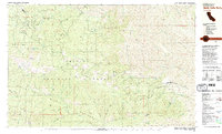
1981 Map of North Yolla Bolly
USGS Topo · Published 1981About this map
The crest of the Yolla Bolly mountains defines this high-altitude landscape along the border of the Trinity National Forest and Mendocino National Forest. Mapped in the early 1980s, the area is characterized by the expansive Yolla Bolly-Middle Eel Wilderness, where drainage systems like the East Fork South Fork Trinity River and Beegum Creek carve deep canyons through ridges named after local figures and settlers. Human activity in this remote backcountry is represented by the Saddle Camp Forest Service Station, the historic Tomhead Mine, and various outposts such as Baker Camp and the Weston Ranch. The presence of features like Miners Cabin Spring and the Petijohn Trail highlights a legacy of prospecting and resource management in the high basins surrounding North Yolla Bolly Lake.
Find a feature on this map
73 named features on this map. Tap any name to fly to it.
Don’t see what you’re looking for? This feature index may not catch every label — zoom into the map to look around manually.
Map Details
Editions of this 1981 North Yolla Bolly Map
This is the sole edition of this map. No revisions or reprints were ever made.
Other maps of this area

1890 · Red Bluff
USGS Topo · 1:250,000

1894 · Red Bluff
USGS Topo · 1:250,000

1931 · Hoaglin
USGS Topo · 1:96,000

1935 · Hoaglin
USGS Topo · 1:125,000

1949 · Colyear Springs
USGS Topo · 1:62,500

1951 · Chanchelulla Peak
USGS Topo · 1:62,500

1952 · Ono
USGS Topo · 1:62,500

1953 · Blackrock Mtn
USGS Topo · 1:62,500

1954 · Dubakella Mtn
USGS Topo · 1:62,500

1954 · Blackrock Mtn
USGS Topo · 1:62,500