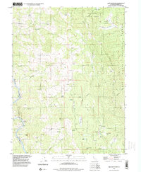
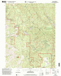
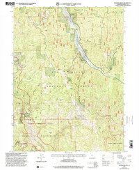
1990s Maps of Trinity County, California
Explore 71 historic maps of Trinity County from the 1990s. These maps offer a rare glimpse into what life looked like during the 1990s — showing old roads, neighborhoods, homes, and landmarks that have changed or disappeared over time.
Whether you're researching your family's past, planning a metal detecting trip, or studying how Trinity County's landscape evolved across the 1990s, these high-resolution maps are a powerful tool for exploring the history of this region.
- Focus on a specific era: All maps on this page are from the 1990s, giving you a focused view of this time period.
- See what’s changed: Compare century-old streets, trails, and buildings to today's modern landscape using overlays and satellite layers.
- Research with precision: Use these maps for genealogy, historical research, land use analysis, or educational projects.
- View, download, or print: Maps are fully viewable online in high resolution, and can be downloaded or printed for your own records.
Start exploring Trinity County's history through authentic maps from the 1990s. This is your window into the past.
Trinity County, CA maps
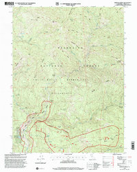
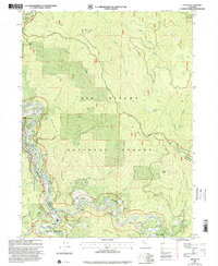
(71)- 1995 Map of Leech Lake Mountain, 2001 Print
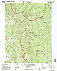
 1995 Leech Lake Mountain2001 Print · USGSThe Middle Fork Eel River corridor in the mid-1990s offers a detailed look at the high-country outposts and wilderness boundaries of Northern California. Researchers can locate remote legacy sites like Osborn Station, Reeves Place, and Hotel Camp along the steep ridges.
 - 1995 Map of Wrights Ridge, 2001 Print
 1995 Wrights Ridge2001 Print · USGSTrinity County's high forest interior is captured here in the mid-1990s, showcasing the remote ridgelines and water sources of the Eel River watershed. Researchers can trace the locations of historic backcountry sites like Flournoy Cabin, the Indian Dick FS Station, and Lazyman Flat.
 - 1995 Map of Bluenose Ridge, 2001 Print
 1995 Bluenose Ridge2001 Print · USGSThe northern reaches of the Mendocino National Forest are captured in the mid-1990s, where tribal lands meet high mountain ridges. Researchers can trace the borders of the Round Valley Indian Reservation and locate old sites like Brown Ranch and Salt Rock Camp (Site).
 - 1995 Map of Solomon Peak, 2001 Print
 1995 Solomon Peak2001 Print · USGSThe California high country is captured here during the 1990s at the intersection of three national forests and the wilderness divide. Researchers can locate remote outposts like Johnson Headquarters and Hawk Camp or trace the rugged ridges between Solomon Peak and Sugarloaf Mountain.
 - 1995 Map of Buck Rock, 2001 Print
 1995 Buck Rock2001 Print · USGSHigh in the California Coast Range during the mid-nineties, this area shows a landscape defined by forest management and wilderness preservation. Researchers can trace the French Trail across high ridges to remote locales like Pony Meadows, Slanes Flat, and Hammerhorn Lake.
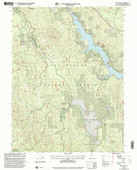
 - 1996 Map of Lake Mountain, 2000 Print
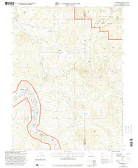
 1996 Lake Mountain2000 Print · USGSTrinity County ranchlands and river canyons are preserved here during the late nineties, showcasing a landscape of high-altitude peaks and remote outposts. Researchers can trace the Northwestern Pacific line past Island Mountain or locate family sites like Jamison Ranch and Frazier Gardens.
 - 1997 Map of Sims Mountain
 1997 Sims Mountain1997 Print · USGSHumboldt and Trinity counties are shown during the late 1990s, where the river-cut canyons meet the high ridges of the national forests. Researchers can trace the remote locations of Manzanita Ranch, Wise Station, and the Last Chance Trail through the wilderness.
 - 1997 Map of Trinity Mountain, 2001 Print
 1997 Trinity Mountain2001 Print · USGSThe high backcountry of the Humboldt and Trinity county line comes into focus in the late nineties, showing a landscape defined by forest service outposts and ridgeline trails. Trace the locations of historic camps like Lipps Camp and One Mile Camp or landmarks like Graveyard Prairie.
 - 1997 Map of Black Lassic, 2001 Print
 1997 Black Lassic2001 Print · USGSThe high peaks of the Humboldt-Trinity county line are captured here in the late 1990s as the regional landscape supported seasonal ranching and timber work. Researchers can trace the drainages of the Van Duzen River and locate remote landmarks like Dutchman Camp, Senteney Rock, and Fingal Ranch.
 - 1997 Map of Zenia, 2001 Print
 1997 Zenia2001 Print · USGSThe Trinity County mountains in the late nineties remain a remote landscape of forest camps and isolated ranching valleys. Researchers can locate family landmarks like Shannon Ranch, the Atkinson Historical Site, and the remote Kettenpom Peak Lookout.
 - 1997 Map of Shannon Butte, 2001 Print
 1997 Shannon Butte2001 Print · USGSTrinity County ranchlands and river canyons are captured here in the late nineties, showing a landscape of remote outposts and wilderness. Researchers can locate family landmarks like Gilman Ranch or Russ Place and trace the Mad River past Ruth County Airport.
 - 1997 Map of Dinsmore, 2001 Print
 1997 Dinsmore2001 Print · USGSThe mountain communities of the California coast range are documented here in the late nineties, centered on the river valleys of the Six Rivers National Forest. Researchers can trace the layout of Dinsmore and Mad River, including local landmarks like Southern Trinity High School and the Dinsmore-Humboldt County Airport.
 - 1997 Map of Blake Mountain, 2001 Print
 1997 Blake Mountain2001 Print · USGSThe Humboldt and Trinity county borderlands come alive in this late-nineties survey of the high ridge country. Researchers can trace the legacy of remote outposts and water sources at Becker Cabin (Site), Skull Camp, and Happy Jack Spring.
 - 1997 Map of Four Corners Rock, 2001 Print
 1997 Four Corners Rock2001 Print · USGSTrinity and Tehama County land is shown here during the late nineties, centered on the high ridges of the Yolla Bolly-Middle Eel Wilderness. Local historians can trace old mountain outposts like Travis Ranch and Vann Cabin or locate industrial sites such as the Blue Jay Mine (Site).
 - 1997 Map of Salmon Mountain, 2001 Print
 1997 Salmon Mountain2001 Print · USGSThe Salmon Mountains high country is captured here in the late 1990s, where three national forests meet. Researchers can trace remote trails and peaks like Salmon Mountain, Mullens Camp, and Red Cap Prairie across this wilderness landscape.
 - 1997 Map of Alderpoint, 2001 Print
 1997 Alderpoint2001 Print · USGSThe Eel River valley in the late 1990s was a landscape of remote ranches and mountainous forest service land. Researchers can find old educational sites like Jewett Sch and family landmarks such as Ware Ranch or the Cain Rock Crossing.
 - 1997 Map of Hennessy Peak, 2001 Print
 1997 Hennessy Peak2001 Print · USGSThe Trinity and Klamath rivers converge in this late-nineties survey of the Humboldt and Trinity county line. Trace the path of the South Fork Trinity River past Cedar Grove Ranch and the lookout at Hennessy Peak.
 - 1997 Map of Long Ridge, 2001 Print
 1997 Long Ridge2001 Print · USGSIn the Trinity and Mendocino backcountry during the late 1990s, this landscape preserved a legacy of remote ranching and indigenous lands. Trace family-named locations such as Wilburn Ranch, the Billie Hoaglin Place, and the Fannie Willburn Historical Site Cem.
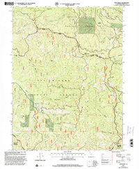
 - 1997 Map of Lake Mountain, 2001 Print
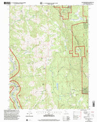 1997 Lake Mountain2001 Print · USGSTrinity County ranching and timber lands are documented here in the late twentieth century, showing a remote landscape of high ridges and forest inholdings. Researchers can locate family landmarks such as Jamison Ranch, the Lake Mountain Landing Strip, and Prospect Mines.
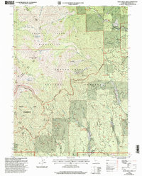
 - 1997 Map of Forest Glen, 2001 Print
 1997 Forest Glen2001 Print · USGSTrinity County's high forest country was documented here in the late nineties, showcasing the rugged drainage of the South Fork Trinity River. Researchers can locate family landmarks like Terrat Ranch, the lonely Grave at Hell Gate, and the Forest Glen Ranger Station.
 - 1997 Map of Salyer, 2001 Print
 1997 Salyer2001 Print · USGSThe Trinity River canyon in the late nineties was a landscape of small mountain outposts and vast protected forests. Genealogists and historians can trace the foundations of local life at Salyer, Trinity Village, and Sandy Bar, or locate the Schoolhouse and Mine that once served the community.
 - 1997 Map of Ruth Lake, 2001 Print
 1997 Ruth Lake2001 Print · USGSTrinity County in the late nineties is defined here by the forest management and reservoir development of the Six Rivers and Trinity National Forests. Researchers can trace land use through sites like the Old Wilburn Ranch, Ueland Place, and the Robert W Matthews Dam.
 - 1997 Map of Swim Ridge, 2001 Print
 1997 Swim Ridge2001 Print · USGSTrinity and Humboldt counties appear in the late 1990s as a densely forested wilderness at the junction of two national forests. Trace the paths of early prospectors and rangers through the Bonanza Mine, Lucky Sunday Mine, and the Yolla Bolly Mad River Trail.
 - 1998 Map of Rush Creek Lakes, 2003 Print
 1998 Rush Creek Lakes2003 Print · USGSThe Trinity Alps region in the late nineties shows a landscape of high wilderness peaks and deep river canyons. Researchers can trace historic mining sites like Tip Top Mine and Arbuckle Mine or locate early recreation hubs such as the Trinity Alps Resort.
 - 1998 Map of Junction City, 2003 Print
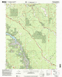
 1998 Junction City2003 Print · USGSThe river canyon of Trinity County comes alive in the late nineties, documenting a landscape defined by its mining heritage and rugged terrain. Researchers can trace the extensive tailings along the Trinity River and locate historic sites like Benjamin Flat and Sheridan.
Showing maps 1-25 of 71
Top cities of Trinity County
- Weaverville historical maps
- Hayfork historical maps
- Lewiston historical maps
- Trinity Village historical maps
- Ruth historical maps
- Zenia historical maps
Frequently asked questions
- What are the different types of historical maps available for Trinity County?
- What is the oldest map of Trinity County?
- Where can I purchase historical maps of Trinity County for my home or office?
- Where can I download high-res historical maps of Trinity County?
- Are there historical topographic maps available for Trinity County?
- Is there historical aerial imagery available for Trinity County?
- Where are historical maps of Trinity County sourced from?