1970s Maps of Trinity County, California
Explore 23 historic maps of Trinity County from the 1970s. These maps offer a rare glimpse into what life looked like during the 1970s — showing old roads, neighborhoods, homes, and landmarks that have changed or disappeared over time.
Whether you're researching your family's past, planning a metal detecting trip, or studying how Trinity County's landscape evolved across the 1970s, these high-resolution maps are a powerful tool for exploring the history of this region.
- Focus on a specific era: All maps on this page are from the 1970s, giving you a focused view of this time period.
- See what’s changed: Compare century-old streets, trails, and buildings to today's modern landscape using overlays and satellite layers.
- Research with precision: Use these maps for genealogy, historical research, land use analysis, or educational projects.
- View, download, or print: Maps are fully viewable online in high resolution, and can be downloaded or printed for your own records.
Start exploring Trinity County's history through authentic maps from the 1970s. This is your window into the past.
Trinity County, CA maps
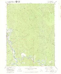
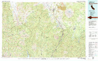
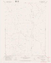
(23)- 1973 Map of Sportshaven, 1977 Print
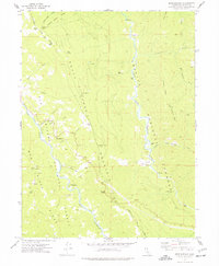 1973 Sportshaven1977 Print · USGSTrinity County in the early 1970s shows a landscape of deep river forks and isolated mountain homesteads. Researchers can trace historic sites like the Klondike Mine and family-named landmarks including McClellan Place and Olsen Creek.
 - 1977 Map of Dinsmore, 1978 Print
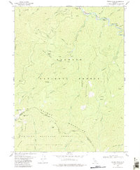
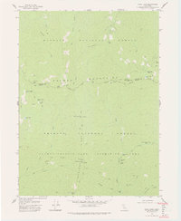
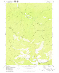
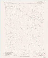 1977 Dinsmore1978 Print · USGSThe Humboldt and Trinity county line meets in this 1970s survey of the mountain forests and river valleys. Researchers can trace the local infrastructure of Dinsmore, from the Southern Trinity High School to the Dinsmore-Humboldt County Airport.2 unique versions available
 - 1978 Map of Ruth Reservoir
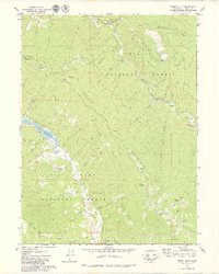
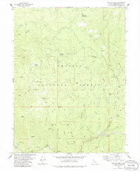
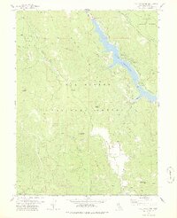 1978 Ruth Reservoir1978 Print · USGSTrinity County in the late seventies is marked by the waters of Ruth Reservoir and the high ridges of the national forests. Researchers can trace family-named sites like Old Willburn Ranch, Ueland Place (Site), and the remote Old Womans Home.3 unique versions available
 - 1978 Map of Blake Mountain
 1978 Blake Mountain1978 Print · USGSThe Humboldt and Trinity county lines meet in the late 1970s along the ridges of the Six Rivers National Forest. Researchers can trace old mountain sites and trails like Becker Cabin (Site), Eightmile Lookout, and the Blake Trail.
 - 1978 Map of Salmon Mtn.
 1978 Salmon Mtn.1978 Print · USGSThe Salmon Mountains reach their peak in the late 1970s within this high-country wilderness where three national forests converge. Trace remote ridge routes like Devils Backbone and Horse Trail Ridge to reach Mullens Camp or Red Cap Lake.2 unique versions available
 - 1978 Map of Shasta Bally
 1978 Shasta Bally1978 Print · USGSThe high peaks of the Shasta-Trinity border are captured here in the late seventies, showing a landscape defined by rugged summits and water management. Hikers and historians can trace the Jerusalem Trail or locate remote landmarks like Coggins Park and Musselbeck Dam.
 - 1978 Map of Dees Peak
 1978 Dees Peak1978 Print · USGSTrinity County in the late 1970s is shown here as a wilderness preserved within the primitive area and national forests. Genealogists and historians can locate former mining hubs and sites like White Rock City, Old Denny, and the Boomer Mine.3 unique versions available
 - 1978 Map of Black Lassic
 1978 Black Lassic1978 Print · USGSThe high peaks of the Six Rivers National Forest are captured in the late seventies, showing the boundary between Humboldt and Trinity counties. Researchers can trace remote locales like the Dutchman Camp (site), the Fingal Ranch, and landmarks like Black Lassic and Pine Mountain.
 - 1979 Map of Salyer
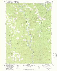
 1979 Salyer1979 Print · USGSIn the late 1970s, the Klamath Mountains landscape was defined by the winding waters of the Trinity River. Genealogists and historians can trace riverside settlements like Salyer and Trinity Village, or locate the Cem and Mine sites tucked along the ridges.2 unique versions available
 - 1979 Map of Sims Mountain
 1979 Sims Mountain1979 Print · USGSHumboldt and Trinity counties meet along the river in the late seventies, a time of remote forest management and high-country ranching. Genealogists and local historians can trace isolated landmarks like Margarita Ranch, the Dan East Cabin, and the crossing at Mule Bridge.
 - 1979 Map of Youngs Peak
 1979 Youngs Peak1979 Print · USGSThe Salmon Mountains in the late seventies reveal a landscape shaped by historical mining and deep wilderness at the Siskiyou and Trinity county line. Researchers can trace the heritage of gold-era sites like the Knownothing Mine, Gilta Mine, and Barton Cabin.
 - 1979 Map of Hennessy Peak
 1979 Hennessy Peak1979 Print · USGSThe Trinity River backcountry in the late seventies is captured here at the junction of Humboldt and Trinity counties. Researchers can trace remote mountain outposts and local landmarks like Hawkins Bar, Cedar Grove Ranch, and the high summit of Hennessy Peak.2 unique versions available
 - 1979 Map of Red Bluff
 1979 Red Bluff1979 Print · USGSTehama and Shasta counties come alive in the late seventies as the agricultural heart of the northern valley meets the high wilderness. Genealogists and local historians can trace the rail-and-river corridor from Red Bluff to Los Molinos, finding sites like Balls Ferry and the Southern Pacific line.3 unique versions available
 - 1979 Map of Forest Glen
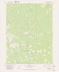
 1979 Forest Glen1979 Print · USGSThe remote mountain country of Trinity County is captured here in the late 1970s, focused on the rugged convergence of national forest lands. Researchers can locate the Pickett Peak Lookout and trace old family sites and settlements like Dashields and Stockton Flat.2 unique versions available
 - 1979 Map of Mount Shasta
 1979 Mount Shasta1979 Print · USGSUpper California's mountainous landscape appears in the late seventies as a busy network of timber towns, railroads, and high-altitude mining claims. Trace the legacy of extraction and industry through the Southern Pacific rail line and sites like McCloud and the Bonanza King Mine.3 unique versions available
 - 1979 Map of Cecil Lake
 1979 Cecil Lake1979 Print · USGSTrinity and Siskiyou counties meet in the high backcountry during the late seventies, preserving a landscape of primitive wilderness and historical pack trails. Researchers can trace the footprints of old mountain camps and dwellings like Fosters Cabin, Hull Cabin, and Election Camp.2 unique versions available
 - 1979 Map of Blake Mountain
 1979 Blake Mountain1979 Print · USGSHumboldt and Trinity Counties are shown at a peak moment of forestry and fire management in the late seventies. Researchers can locate remote historical sites like the Becker Cabin (Site), the Eightmile Lookout, and the old Torrey Corrals.3 unique versions available
 - 1979 Map of French Gulch
 1979 French Gulch1979 Print · USGSThe Trinity Mountains were still a hub of gold mining and mountain transit in the late seventies. You can trace the legacy of the local gold rush through sites like the Brown Bear Mine, the settlement of French Gulch, and the old Lewiston Turnpike Road.2 unique versions available
 - 1979 Map of Black Lassic
 1979 Black Lassic1979 Print · USGSHumboldt and Trinity counties are shown during the late 1970s, a period of managed wilderness within the Six Rivers National Forest. Researchers can locate remote high-country outposts like Dutchman Camp, Summit Flat, and Fingal Ranch alongside the distinctive peaks of the Lassic range.3 unique versions available
 - 1979 Map of Thompson Peak
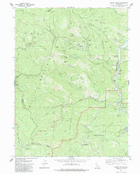
 1979 Thompson Peak1979 Print · USGSThe Salmon River backcountry of Siskiyou and Trinity counties is captured here in the late seventies, a landscape of high-alpine basins and early mining traces. Researchers can locate the Moliter Mine, the mountain settlement of Summerville, and remote sites like Schoolhouse Flat.3 unique versions available
 - 1979 Map of Naufus Creek, 1980 Print
 1979 Naufus Creek1980 Print · USGSNorthern California’s high forest country is documented here during the late 1970s, showcasing a landscape defined by the South Fork Trinity River. Researchers can locate historic sites like Friend Place, Big Flat of Naufus, and early Prospects near Copper Hill.
 - 1979 Map of Trinity Mtn, 1980 Print
 1979 Trinity Mtn1980 Print · USGSThe high ridges of the Humboldt and Trinity county line are shown here in the late 1970s, before modern wilderness designations were fully fixed. Researchers can trace remote pack trails to Onemile Camp, Lipps Camp, and the distinctive Ladder Rock.
 - 1979 Map of Garberville, 1996 Print
 1979 Garberville1996 Print · USGSThe redwood forests and river canyons of Humboldt and Trinity counties are shown here in the late seventies. Genealogists and historians can trace rail-side life along the Northwestern Pacific RR or locate small settlements like Fort Seward, Alderpoint, and Zenia.
End of results
Showing maps 1-23 of 23
Top cities of Trinity County
- Weaverville historical maps
- Hayfork historical maps
- Lewiston historical maps
- Trinity Village historical maps
- Ruth historical maps
- Zenia historical maps
Frequently asked questions
- What are the different types of historical maps available for Trinity County?
- What is the oldest map of Trinity County?
- Where can I purchase historical maps of Trinity County for my home or office?
- Where can I download high-res historical maps of Trinity County?
- Are there historical topographic maps available for Trinity County?
- Is there historical aerial imagery available for Trinity County?
- Where are historical maps of Trinity County sourced from?