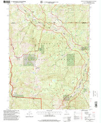
1995 Map of Leech Lake Mountain
USGS Topo · Published 2001About this map
Leech Lake Mountain stands as a prominent landmark within this 1995 revision of the northern California wilderness, where the Mendocino National Forest meets the Yolla Bolly Middle Eel Wilderness. The landscape is defined by the steep drainage of the Middle Fork Eel River, designated here as a Scenic River. Historical human activity is marked by isolated outposts and early travel routes, including the Osborn Station and Travelers Home. Genealogists and local historians can trace legacy sites such as Foster Ranch, Reeves Place, and the curiously named Hotel Camp. The intricate topography of Taliaferro Ridge and Pine Ridge is punctuated by seasonal water sources like Bear Trap Spring and remote meadows including Airplane Meadow. This survey highlights the intersection of the Trinity and Mendocino county lines amidst a network of high-elevation glades and flats.
Find a feature on this map
62 named features on this map. Tap any name to fly to it.
Don’t see what you’re looking for? This feature index may not catch every label — zoom into the map to look around manually.
Map Details
Editions of this 1995 Leech Lake Mountain Map
This is the sole edition of this map. No revisions or reprints were ever made.
Other maps of this area

1890 · Red Bluff
USGS Topo · 1:250,000

1894 · Red Bluff
USGS Topo · 1:250,000

1926 · Covelo
USGS Topo · 1:62,500

1931 · Hoaglin
USGS Topo · 1:96,000

1935 · Hoaglin
USGS Topo · 1:125,000

1952 · Covelo
USGS Topo · 1:62,500

1952 · Anthony Peak
USGS Topo · 1:62,500

1953 · Blackrock Mtn
USGS Topo · 1:62,500

1954 · Blackrock Mtn
USGS Topo · 1:62,500

1954 · Yolla Bolly
USGS Topo · 1:62,500