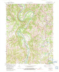
2022 Map of Alexandria
USGS Topo · Published 2022About this map
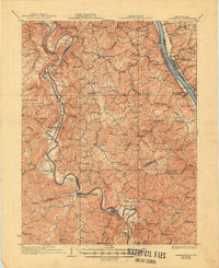
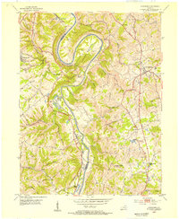
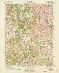
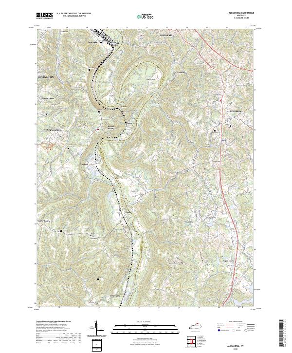
The Licking River carves a winding path through the heart of this Northern Kentucky landscape, creating dramatic oxbows like Grants Bend and Big Bend. This 2022 survey captures a transition between the established centers of Alexandria and Independence and the more rural ridge-and-valley communities that define Kenton and Campbell Counties. The map is particularly rich for genealogical research, documenting numerous family and community burial sites including the Pruett - Mardis Cem, Simmons Cem, and Klette Cem. Small settlements like Visalia and Claryville are linked by a complex network of historic routes such as DeCoursey Pike and Alexandria Pike, reflecting an enduring pattern of upland development. From the heights of Visalia Hill to the banks of Phillips Creek, the terrain illustrates the significant elevation changes that have historically influenced road placement and local agriculture in this portion of the Bluegrass region.
Find a feature on this map
165 named features on this map. Tap any name to fly to it.
Don’t see what you’re looking for? This feature index may not catch every label — zoom into the map to look around manually.
Map Details
Editions of this 2022 Alexandria Map
This is the sole edition of this map. No revisions or reprints were ever made.
Historical Maps of Visalia Through Time
6 maps found