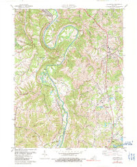
1981 Map of Alexandria
USGS Topo · Published 1991About this map
The Licking River carves a dramatic oxbow at Grants Bend, defining the rugged border between Kenton and Campbell Counties during the early 1980s. This survey captures a rural landscape transitioning toward suburban growth, anchored by the settlement of Alexandria to the east and Visalia along the riverbanks. The Louisville and Nashville railroad tracks follow the western river valley, serving established communities like Latonia Lakes and Ryland Heights. Local social and educational hubs are clearly marked, including Bishop Brossart High Sch and several country churches such as St Mary Ch and Pleasant Ridge Ch. To the south, the expansive A J Jolly County Park and Campbell County Lake highlight the area's recreational development, while numerous ridge roads like Persimmon Grove Rd trace the upland topography between the river valleys.
Find a feature on this map
55 named features on this map. Tap any name to fly to it.
Don’t see what you’re looking for? This feature index may not catch every label — zoom into the map to look around manually.
Map Details
Editions of this 1981 Alexandria Map
2 editions found
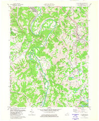
Other maps of this area

1898 · East Cincinnati
USGS Topo · 1:62,500

1914 · East Cincinnati
USGS Topo · 1:62,500

1914 · West Cincinnati
USGS Topo · 1:62,500

1929 · Alexandria
USGS Topo · 1:48,000

1936 · Alexandria
USGS Topo · 1:62,500

1950 · Independence
USGS Topo · 1:24,000

1950 · Walton
USGS Topo · 1:24,000

1950 · Covington
USGS Topo · 1:24,000

1952 · Newport
USGS Topo · 1:24,000

1953 · Withamsville
USGS Topo · 1:24,000