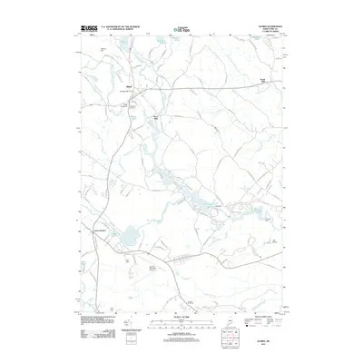
2011 Map of Alfred
USGS Topo · Published 2011About this map
The town of Alfred serves as a central hub in this survey of York County, where the Middle Branch Mousam River winds through a landscape defined by historically significant water bodies and early industrial sites. Local industry is anchored by the presence of Alfred Mills and Spang Mills, illustrating the historical reliance on the river's power. To the south, the development of South Sanford is marked by the sprawling Sanford Municipal Airport and the nearby Sanford Speedway. The river's path is punctuated by engineering works including the Trafton Brook Dam, New Dam, and Old Falls Dam at Old Falls Pond. Notable family-named landmarks like Brackett Hill and Yeaton Hill provide topographical context for genealogists, while Evergreen Cemetery offers a critical site for local family history research.
Find a feature on this map
118 named features on this map. Tap any name to fly to it.
Don’t see what you’re looking for? This feature index may not catch every label — zoom into the map to look around manually.
Map Details
Editions of this 2011 Alfred Map
This is the sole edition of this map. No revisions or reprints were ever made.
Other maps of this area

1891 · Berwick
USGS Topo · 1:62,500

1891 · Kennebunk
USGS Topo · 1:62,500

1891 · Buxton
USGS Topo · 1:62,500

1891 · Newfield
USGS Topo · 1:62,500

1892 · Buxton
USGS Topo · 1:62,500

1893 · Kennebunk
USGS Topo · 1:62,500

1893 · Berwick
USGS Topo · 1:62,500

1893 · Buxton
USGS Topo · 1:62,500

1893 · Newfield
USGS Topo · 1:62,500

1898 · Kennebunk
USGS Topo · 1:62,500