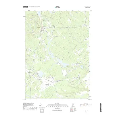
2021 Map of Alfred
USGS Topo · Published 2021About this map
Alfred serves as the focal point of this York County landscape, where the York County Superior Court and the Parish Congregational Church Cem anchor the historic town center. The settlement pattern follows the drainage of the Mousam River and its various tributaries like the Littlefield River, which historically supported local industry at sites like Alfred Mills and Spang Mills. To the south, the expansion of Sanford is evident, characterized by the Sanford Seacoast Regional Airport and more dense residential road networks.
Find a feature on this map
148 named features on this map. Tap any name to fly to it.
Don’t see what you’re looking for? This feature index may not catch every label — zoom into the map to look around manually.
Map Details
Editions of this 2021 Alfred Map
This is the sole edition of this map. No revisions or reprints were ever made.
Other maps of this area

1891 · Berwick
USGS Topo · 1:62,500

1891 · Kennebunk
USGS Topo · 1:62,500

1891 · Buxton
USGS Topo · 1:62,500

1891 · Newfield
USGS Topo · 1:62,500

1892 · Buxton
USGS Topo · 1:62,500

1893 · Kennebunk
USGS Topo · 1:62,500

1893 · Berwick
USGS Topo · 1:62,500

1893 · Buxton
USGS Topo · 1:62,500

1893 · Newfield
USGS Topo · 1:62,500

1898 · Kennebunk
USGS Topo · 1:62,500