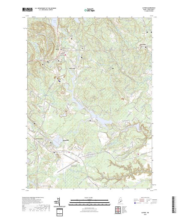
2024 Map of Alfred
USGS Topo · Published 2024About this map
Alfred serves as the focal point of this York County landscape, where the York County Superior Court and Parish Congregational Church anchor the town center. The region is defined by the winding course of the Middle Branch Mousam River and the Mousam River, which feed into Estes Lake and Jagger Pond. To the south, the industrial and residential expansion of Sanford and South Sanford is evident, situated near the Sanford Seacoast Regional Airport. Numerous family burial grounds, including the Nutter Family Cem, Friend Family Cem, and Linscott Family Cem, are scattered across the terrain, reflecting the deep genealogical roots of the area. Significant tracts of land like the Gordon Lot and Bickford Morse Lot suggest a history of organized woodlots or family landholdings amidst the hills of Yeaton Hill and Brackett Hill.
Find a feature on this map
147 named features on this map. Tap any name to fly to it.
Don’t see what you’re looking for? This feature index may not catch every label — zoom into the map to look around manually.
Map Details
Editions of this 2024 Alfred Map
This is the sole edition of this map. No revisions or reprints were ever made.
Other maps of this area

1891 · Berwick
USGS Topo · 1:62,500

1891 · Kennebunk
USGS Topo · 1:62,500

1891 · Buxton
USGS Topo · 1:62,500

1891 · Newfield
USGS Topo · 1:62,500

1892 · Buxton
USGS Topo · 1:62,500

1893 · Kennebunk
USGS Topo · 1:62,500

1893 · Berwick
USGS Topo · 1:62,500

1893 · Buxton
USGS Topo · 1:62,500

1893 · Newfield
USGS Topo · 1:62,500

1898 · Kennebunk
USGS Topo · 1:62,500