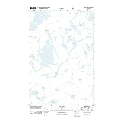
2011 Map of Alice Lake
USGS Topo · Published 2011About this map
Alice Lake dominates this northern Minnesota landscape, serving as a central hub in a complex network of glacial water bodies within Lake County. The 2011 survey reveals an intricate wilderness geography where large lakes such as Thomas Lake and Lake Insula are connected by narrow channels and smaller basins like Cacabic Lake and Fraser Lake. This region is defined by its lack of roads and settlements, reflecting a protected environment where natural waterways provide the primary infrastructure. Drainage patterns are articulated by features such as Record Creek and River Lake, which link the eastern basins toward Malberg Lake. The map serves as a precise record of the shoreline configurations for dozens of named lakes, including Amber Lake, Fishdance Lake, and the remote Adams Lake near the northern boundary.
Find a feature on this map
41 named features on this map. Tap any name to fly to it.
Don’t see what you’re looking for? This feature index may not catch every label — zoom into the map to look around manually.
Map Details
Editions of this 2011 Alice Lake Map
This is the sole edition of this map. No revisions or reprints were ever made.
Other maps of this area

1954 · Two Harbors
USGS Topo · 1:250,000

1957 · Two Harbors
USGS Topo · 1:250,000

1957 · Ensign Lake
USGS Topo · 1:62,500

1957 · Quetico
USGS Topo · 1:250,000

1958 · Two Harbors
USGS Topo · 1:250,000

1959 · Ogishkemuncie Lake
USGS Topo · 1:24,000

1959 · Kekekabic Lake
USGS Topo · 1:24,000

1960 · Lake Polly
USGS Topo · 1:24,000

1960 · Kawishiwi Lake
USGS Topo · 1:24,000

1960 · Perent Lake
USGS Topo · 1:24,000