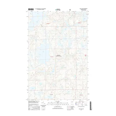
2016 Map of Alice Lake
USGS Topo · Published 2016About this map
Superior National Forest encompasses this vast aquatic landscape in northern Minnesota, where a labyrinth of interconnected waterways defines the region's character. At the center of the sheet, Alice Lake serves as a major hydrologic hub, receiving the flow of the Kawishiwi River as it winds through the glacial terrain. The map documents an intricate network of portages and water routes, including the Thomas-Caeabie trail connecting Thomas Lake to smaller northern basins. This 2016 survey illustrates the pristine nature of the Boundary Waters area, where named features are almost exclusively limited to natural landmarks like Fishdance Lake, Amber Lake, and Lake Insula. For the researcher or outdoorsman, the map provides a precise record of the shoreline configurations and small islands within remote basins such as Malberg Lake and Fraser Lake before modern environmental shifts might alter these wilderness boundaries.
Find a feature on this map
49 named features on this map. Tap any name to fly to it.
Don’t see what you’re looking for? This feature index may not catch every label — zoom into the map to look around manually.
Map Details
Editions of this 2016 Alice Lake Map
This is the sole edition of this map. No revisions or reprints were ever made.
Other maps of this area

1954 · Two Harbors
USGS Topo · 1:250,000

1957 · Two Harbors
USGS Topo · 1:250,000

1957 · Ensign Lake
USGS Topo · 1:62,500

1957 · Quetico
USGS Topo · 1:250,000

1958 · Two Harbors
USGS Topo · 1:250,000

1959 · Ogishkemuncie Lake
USGS Topo · 1:24,000

1959 · Kekekabic Lake
USGS Topo · 1:24,000

1960 · Lake Polly
USGS Topo · 1:24,000

1960 · Kawishiwi Lake
USGS Topo · 1:24,000

1960 · Perent Lake
USGS Topo · 1:24,000