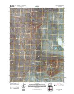
2011 Map of Alkali Buttes
USGS Topo · Published 2011About this map
North Alkali Lake anchors the eastern edge of this high-desert landscape in Lake County, a region characterized by its arid basins and volcanic landforms. The terrain is marked by the distinctive Alkali Buttes, which rise above the surrounding flats in the southeastern portion of the quadrangle. Transportation through this sparsely settled territory is defined by the Old Burns Hwy, which cuts across the central basin. This 2011 survey by the U.S. Geological Survey reflects the enduring rural character of south-central Oregon, where few permanent structures exist beyond the infrastructure of the old highway and the natural hydrologic features of the alkali basin.
Find a feature on this map
3 named features on this map. Tap any name to fly to it.
Don’t see what you’re looking for? This feature index may not catch every label — zoom into the map to look around manually.
Map Details
Editions of this 2011 Alkali Buttes Map
This is the sole edition of this map. No revisions or reprints were ever made.
Other maps of this area

1955 · Crescent
USGS Topo · 1:250,000

1955 · Klamath Falls
USGS Topo · 1:250,000

1955 · Burns
USGS Topo · 1:250,000

1955 · Adel
USGS Topo · 1:250,000

1957 · Adel
USGS Topo · 1:250,000

1957 · Crescent
USGS Topo · 1:250,000

1958 · Crescent
USGS Topo · 1:250,000

1958 · Klamath Falls
USGS Topo · 1:250,000

1958 · Burns
USGS Topo · 1:250,000

1958 · Adel
USGS Topo · 1:250,000