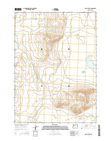
2014 Map of Alkali Buttes
USGS Topo · Published 2014About this map
Alkali Buttes rise above the high desert floor in this 2014 survey of Lake County, Oregon. The landscape is characterized by its arid, endorheic basins and volcanic elevations, notably Doughtnut Mountain and the expansive Poverty Basin to the northwest. This modern topographic record captures the specific hydrological conditions of the era, including the seasonal waters of N Alkali Lake and isolated water sources like Harmon Spg. The map provides a precise look at the township and range survey system, documenting the remote road network including Four Corners Wls and tracks skirting the base of Horse Mtn. It is a vital record for understanding land use and water management in one of Oregon’s most sparsely populated high-plateau regions.
Find a feature on this map
15 named features on this map. Tap any name to fly to it.
Don’t see what you’re looking for? This feature index may not catch every label — zoom into the map to look around manually.
Map Details
Editions of this 2014 Alkali Buttes Map
This is the sole edition of this map. No revisions or reprints were ever made.
Other maps of this area

1955 · Crescent
USGS Topo · 1:250,000

1955 · Klamath Falls
USGS Topo · 1:250,000

1955 · Burns
USGS Topo · 1:250,000

1955 · Adel
USGS Topo · 1:250,000

1957 · Adel
USGS Topo · 1:250,000

1957 · Crescent
USGS Topo · 1:250,000

1958 · Crescent
USGS Topo · 1:250,000

1958 · Klamath Falls
USGS Topo · 1:250,000

1958 · Burns
USGS Topo · 1:250,000

1958 · Adel
USGS Topo · 1:250,000