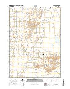
2017 Map of Alkali Buttes
USGS Topo · Published 2017About this map
Alkali Buttes rise as a prominent landform above the surrounding desert floor in this high-desert region of Lake County. The landscape is defined by the broad Alkali Valley and the northern reaches of N Alkali Lake on the eastern edge of the quadrangle. This 2017 survey by the U.S. Geological Survey reflects the modern topography of an arid basin where internal drainage patterns dictate the placement of seasonal lake beds. The lack of permanent structures or towns highlights the isolation of this corner of Oregon, which remains primarily organized by the Public Land Survey System grids, such as t29s r23e.
Find a feature on this map
9 named features on this map. Tap any name to fly to it.
Don’t see what you’re looking for? This feature index may not catch every label — zoom into the map to look around manually.
Map Details
Editions of this 2017 Alkali Buttes Map
This is the sole edition of this map. No revisions or reprints were ever made.
Other maps of this area

1955 · Crescent
USGS Topo · 1:250,000

1955 · Klamath Falls
USGS Topo · 1:250,000

1955 · Burns
USGS Topo · 1:250,000

1955 · Adel
USGS Topo · 1:250,000

1957 · Adel
USGS Topo · 1:250,000

1957 · Crescent
USGS Topo · 1:250,000

1958 · Crescent
USGS Topo · 1:250,000

1958 · Klamath Falls
USGS Topo · 1:250,000

1958 · Burns
USGS Topo · 1:250,000

1958 · Adel
USGS Topo · 1:250,000