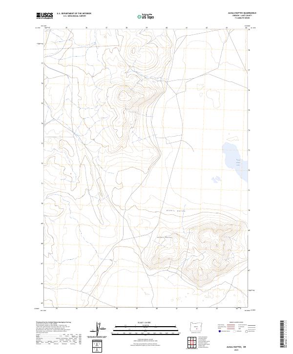
2023 Map of Alkali Buttes
USGS Topo · Published 2023About this map
Alkali Buttes rise above the high desert floor in this remote corner of Lake County, where the topography is defined by the stark transitions of the Great Basin. This 2023 survey by the U.S. Geological Survey details the arid expanse of the Alkali Valley, a landscape characterized by its drainage into North Alkali Lake. The map illustrates a network of desert tracks and section lines that cross the basin, reflecting the vast scale of the Public Land Survey System through townships like t29s r22e and t29s r23e. For those studying the hydrology of Oregon's interior, the relationship between the elevated buttes and the seasonally variable shoreline of the lake provides a clear picture of the region's natural catchments and terminal basins.
Find a feature on this map
9 named features on this map. Tap any name to fly to it.
Don’t see what you’re looking for? This feature index may not catch every label — zoom into the map to look around manually.
Map Details
Editions of this 2023 Alkali Buttes Map
This is the sole edition of this map. No revisions or reprints were ever made.
Other maps of this area

1955 · Crescent
USGS Topo · 1:250,000

1955 · Klamath Falls
USGS Topo · 1:250,000

1955 · Burns
USGS Topo · 1:250,000

1955 · Adel
USGS Topo · 1:250,000

1957 · Adel
USGS Topo · 1:250,000

1957 · Crescent
USGS Topo · 1:250,000

1958 · Crescent
USGS Topo · 1:250,000

1958 · Klamath Falls
USGS Topo · 1:250,000

1958 · Burns
USGS Topo · 1:250,000

1958 · Adel
USGS Topo · 1:250,000