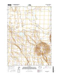
2017 Map of Alkali Lake
USGS Topo · Published 2017About this map
Venator Butte rises above the high desert floor of Lake County, anchoring the southeastern corner of this arid landscape. This 2017 survey captures a remote basin defined by sparse water sources and topographic extremes. Vital for survival in such an environment, named points like Hutton Spring and the evocatively titled Horror Spring are critical landmarks. The presence of Animal Bedground and Nasty Pond suggests a landscape utilized for livestock or wildlife management, where seasonal water and grazing patterns dictate movement.
Find a feature on this map
10 named features on this map. Tap any name to fly to it.
Don’t see what you’re looking for? This feature index may not catch every label — zoom into the map to look around manually.
Map Details
Editions of this 2017 Alkali Lake Map
This is the sole edition of this map. No revisions or reprints were ever made.
Other maps of this area

1955 · Crescent
USGS Topo · 1:250,000

1955 · Klamath Falls
USGS Topo · 1:250,000

1955 · Burns
USGS Topo · 1:250,000

1955 · Adel
USGS Topo · 1:250,000

1957 · Adel
USGS Topo · 1:250,000

1957 · Crescent
USGS Topo · 1:250,000

1958 · Crescent
USGS Topo · 1:250,000

1958 · Klamath Falls
USGS Topo · 1:250,000

1958 · Burns
USGS Topo · 1:250,000

1958 · Adel
USGS Topo · 1:250,000