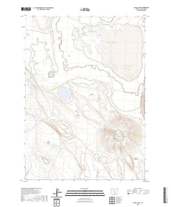
2024 Map of Alkali Lake
USGS Topo · Published 2024About this map
The Alkali Valley floor dominates the northern half of this Lake County quadrangle, showing the distinct seasonal and geographic isolation of the high desert basin. To the south, the terrain shifts dramatically where the contours tighten around the prominent rise of Venator Butte, a significant landmark that breaks the valley horizon. This survey illustrates a sparse, water-dependent landscape where small, named water sources like Horror Spring, Hutton Spring, and the uniquely named Nasty Pond provide the only breaks in the arid expanse. The southern slopes of the butte are marked by the Animal Bedground, while the presence of BLM RD 6104 indicates the modern management of this remote public land. The map offers a clear view of the Public Land Survey System grid, including corners for t30s r23e and t31s r22e, which are essential for tracing historical land claims and grazing rights.
Find a feature on this map
11 named features on this map. Tap any name to fly to it.
Don’t see what you’re looking for? This feature index may not catch every label — zoom into the map to look around manually.
Map Details
Editions of this 2024 Alkali Lake Map
This is the sole edition of this map. No revisions or reprints were ever made.
Other maps of this area

1955 · Crescent
USGS Topo · 1:250,000

1955 · Klamath Falls
USGS Topo · 1:250,000

1955 · Burns
USGS Topo · 1:250,000

1955 · Adel
USGS Topo · 1:250,000

1957 · Adel
USGS Topo · 1:250,000

1957 · Crescent
USGS Topo · 1:250,000

1958 · Crescent
USGS Topo · 1:250,000

1958 · Klamath Falls
USGS Topo · 1:250,000

1958 · Burns
USGS Topo · 1:250,000

1958 · Adel
USGS Topo · 1:250,000