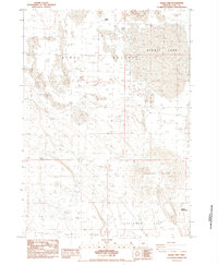
1984 Map of Alkali Lake
USGS Topo · Published 1984About this map
Alkali Lake and the broader Alkali Valley dominate this high desert landscape in Lake County, where water is the primary architect of human and animal movement. The map records a series of ephemeral water sources critical for livestock and desert survival, including the curiously named Horror Spring, Hutton Spring, and Poor Jug Well. These points of relief are scattered across a terrain of Sand Dunes and expansive basins.
Find a feature on this map
11 named features on this map. Tap any name to fly to it.
Don’t see what you’re looking for? This feature index may not catch every label — zoom into the map to look around manually.
Map Details
Editions of this 1984 Alkali Lake Map
This is the sole edition of this map. No revisions or reprints were ever made.
Other maps of this area

1955 · Crescent
USGS Topo · 1:250,000

1955 · Klamath Falls
USGS Topo · 1:250,000

1955 · Burns
USGS Topo · 1:250,000

1955 · Adel
USGS Topo · 1:250,000

1957 · Adel
USGS Topo · 1:250,000

1957 · Crescent
USGS Topo · 1:250,000

1958 · Crescent
USGS Topo · 1:250,000

1958 · Klamath Falls
USGS Topo · 1:250,000

1958 · Burns
USGS Topo · 1:250,000

1958 · Adel
USGS Topo · 1:250,000