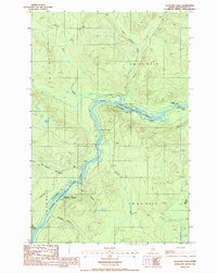
1986 Map of Allagash Falls
USGS Topo · Published 1986About this map
Allagash River serves as the primary artery of this remote northern landscape, winding through the Allagash Wilderness State Waterway. The river's path is marked by significant obstacles and landmarks, including the notable drop at Allagash Falls and the Pelletier Deadwater Islands downstream. Evidence of human presence is sparse but specific, centered on locations like Michaud Farm and Moores Farm, which stand as clearings in an otherwise dense woodland environment.
Find a feature on this map
27 named features on this map. Tap any name to fly to it.
Don’t see what you’re looking for? This feature index may not catch every label — zoom into the map to look around manually.
Map Details
Editions of this 1986 Allagash Falls Map
This is the sole edition of this map. No revisions or reprints were ever made.
Other maps of this area

1930 · Allagash
USGS Topo · 1:48,000

1932 · Allagash Falls
USGS Topo · 1:48,000

1933 · Allagash
USGS Topo · 1:62,500

1935 · Allagash Falls
USGS Topo · 1:62,500

1954 · Presque Isle
USGS Topo · 1:250,000

1955 · Rocky Mountain
USGS Topo · 1:62,500

1955 · Round Pond
USGS Topo · 1:62,500

1956 · Allagash Falls
USGS Topo · 1:50,000

1958 · Presque Isle
USGS Topo · 1:250,000

1960 · Presque Isle
USGS Topo · 1:250,000