
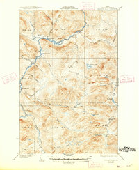
1935 Map of Allagash Falls
USGS Topo · Published 1935About this map
The Allagash River cuts a prominent path through this 1930s northern Maine wilderness, a landscape dominated by timber operations and remote outposts. The interior is marked by specialized camps such as Cunliffe Depot Camp and Five Finger Camp, while the presence of the Tote Road and features like The Corduroys indicate the vital, yet rudimentary, transportation network required for the regional economy. Small-scale agriculture persists at isolated locations like Michaud Farm and Moores Farm, which served as essential supply points in the deep woods.
Find a feature on this map
44 named features on this map. Tap any name to fly to it.
Don’t see what you’re looking for? This feature index may not catch every label — zoom into the map to look around manually.
Map Details
Editions of this 1935 Allagash Falls Map
2 editions found
Other maps of this area

1930 · Allagash
USGS Topo · 1:48,000

1930 · St Francis
USGS Topo · 1:48,000

1931 · Fish River Lake
USGS Topo · 1:48,000

1931 · Mooseleuk Lake
USGS Topo · 1:48,000

1932 · Umsaskis Lake
USGS Topo · 1:48,000

1932 · Musquacook Lakes
USGS Topo · 1:48,000

1932 · Allagash Falls
USGS Topo · 1:48,000

1933 · Allagash
USGS Topo · 1:62,500

1933 · St Francis
USGS Topo · 1:62,500

1935 · Umsaskis Lake
USGS Topo · 1:62,500