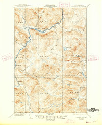
1935 Map of Allagash Falls
USGS Topo · Published 1947About this map
The Allagash River winds through the heart of this North Maine Woods landscape during the early 1930s, showing a region defined by seasonal logging and wilderness travel. The presence of Cunliffe Depot Camp and Mc Keen Camp reflects the area's timber industry heritage, where remote outposts served as hubs for river driving and forestry operations. Small clearings such as Michaud Farm and Moores Farm punctuate the dense forest along the riverbanks, representing the limited agricultural footprints established in this isolated township system.
Find a feature on this map
41 named features on this map. Tap any name to fly to it.
Don’t see what you’re looking for? This feature index may not catch every label — zoom into the map to look around manually.
Map Details
Editions of this 1935 Allagash Falls Map
2 editions found

Other maps of this area

1930 · Allagash
USGS Topo · 1:48,000

1930 · St Francis
USGS Topo · 1:48,000

1931 · Fish River Lake
USGS Topo · 1:48,000

1931 · Mooseleuk Lake
USGS Topo · 1:48,000

1932 · Umsaskis Lake
USGS Topo · 1:48,000

1932 · Musquacook Lakes
USGS Topo · 1:48,000

1932 · Allagash Falls
USGS Topo · 1:48,000

1933 · Allagash
USGS Topo · 1:62,500

1933 · St Francis
USGS Topo · 1:62,500

1935 · Umsaskis Lake
USGS Topo · 1:62,500