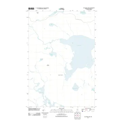
2011 Map of Allagash Lake
USGS Topo · Published 2011About this map
Allagash Lake serves as the central focal point of this North Maine Woods landscape, surrounded by a complex network of glacial ponds and drainages. The area is defined by its water-rich geography, including Upper Ellis Pond, Lower Ellis Pond, and the scattered waters of Poland Pond and Johnson Pond. Terrain features such as Poland Mountain and Allagash Mountain provide relief above the interconnected streams like Wadleigh Stream and Allagash Stream. This 2011 survey documents a remote wilderness managed for timber and conservation, where transport is limited to unpaved corridors like the International Paper Rd and Longley Stream Rd. The map illustrates a typical northern watershed where every ridge, such as Narrow Ridge, dictates the flow of brooks toward larger basins, preserving the character of the Maine backcountry.
Find a feature on this map
23 named features on this map. Tap any name to fly to it.
Don’t see what you’re looking for? This feature index may not catch every label — zoom into the map to look around manually.
Map Details
Editions of this 2011 Allagash Lake Map
This is the sole edition of this map. No revisions or reprints were ever made.
Other maps of this area

1954 · Chesuncook
USGS Topo · 1:62,500

1954 · Caucomgomoc Lake
USGS Topo · 1:62,500

1954 · Churchill Lake
USGS Topo · 1:62,500

1954 · Allagash Lake
USGS Topo · 1:62,500

1954 · Presque Isle
USGS Topo · 1:250,000

1958 · Presque Isle
USGS Topo · 1:250,000

1958 · Chesuncook
USGS Topo · 1:62,500

1958 · Caucomgomoc Lake
USGS Topo · 1:62,500

1960 · Presque Isle
USGS Topo · 1:250,000

1961 · Allagash Lake
USGS Topo · 1:62,500