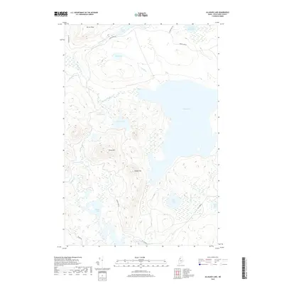
2018 Map of Allagash Lake
USGS Topo · Published 2018About this map
Allagash Lake dominates this northern Maine landscape, serving as a central hub for a complex network of glacial ponds and drainages in Piscataquis County. The surrounding terrain is defined by significant elevations such as Poland Mtn and Allagash Mtn, which overlook a series of smaller water bodies including Johnson Pond and Mountain Pond. The hydrologic pattern reveals a wilderness shaped by its waterways, with the S Br Allagash Stream and Mile Brook feeding into the larger aquatic system. A network of logging and access roads, including Pingree Rd and Narrow Pond Rd, provides the primary human imprint upon this largely undeveloped region. These routes trace the contours between features like Narrow Ridge and the Second South Branch Russell Pond, illustrating the persistent role of timber management and recreation in this remote interior.
Find a feature on this map
26 named features on this map. Tap any name to fly to it.
Don’t see what you’re looking for? This feature index may not catch every label — zoom into the map to look around manually.
Map Details
Editions of this 2018 Allagash Lake Map
This is the sole edition of this map. No revisions or reprints were ever made.
Other maps of this area

1954 · Chesuncook
USGS Topo · 1:62,500

1954 · Caucomgomoc Lake
USGS Topo · 1:62,500

1954 · Churchill Lake
USGS Topo · 1:62,500

1954 · Allagash Lake
USGS Topo · 1:62,500

1954 · Presque Isle
USGS Topo · 1:250,000

1958 · Presque Isle
USGS Topo · 1:250,000

1958 · Chesuncook
USGS Topo · 1:62,500

1958 · Caucomgomoc Lake
USGS Topo · 1:62,500

1960 · Presque Isle
USGS Topo · 1:250,000

1961 · Allagash Lake
USGS Topo · 1:62,500