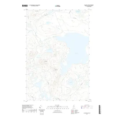
2021 Map of Allagash Lake
USGS Topo · Published 2021About this map
Allagash Lake dominates this northern Maine wilderness, situated within a complex network of glacial ponds and streams. The terrain is defined by prominent elevations such as Poland Mtn and Allagash Mtn, which overlook a series of smaller water bodies including Mountain Pond and Upper Ellis Pond. The drainage pattern is driven by Allagash Stream and its various tributaries like S Br Allagash Stream and Wadleigh Stream, illustrating the hydrologic connectivity of the Maine North Woods. Human presence is limited to a sparse network of unpaved forest routes, such as Narrow Pond Rd and Pingree Rd, which reflect the area's long-standing use for timber management and remote recreation. This survey provides a clear view of the land before further contemporary development, marking the traditional portage and waterway routes that have long served this part of Piscataquis County.
Find a feature on this map
22 named features on this map. Tap any name to fly to it.
Don’t see what you’re looking for? This feature index may not catch every label — zoom into the map to look around manually.
Map Details
Editions of this 2021 Allagash Lake Map
This is the sole edition of this map. No revisions or reprints were ever made.
Other maps of this area

1954 · Chesuncook
USGS Topo · 1:62,500

1954 · Caucomgomoc Lake
USGS Topo · 1:62,500

1954 · Churchill Lake
USGS Topo · 1:62,500

1954 · Allagash Lake
USGS Topo · 1:62,500

1954 · Presque Isle
USGS Topo · 1:250,000

1958 · Presque Isle
USGS Topo · 1:250,000

1958 · Chesuncook
USGS Topo · 1:62,500

1958 · Caucomgomoc Lake
USGS Topo · 1:62,500

1960 · Presque Isle
USGS Topo · 1:250,000

1961 · Allagash Lake
USGS Topo · 1:62,500