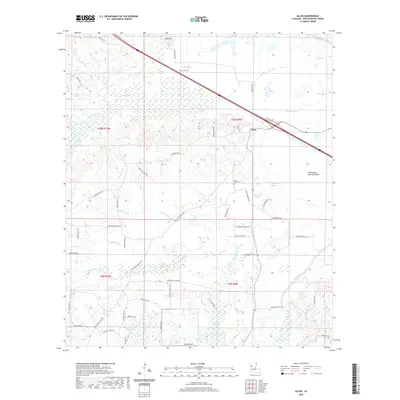
2020 Map of Allen
USGS Topo · Published 2020About this map
Allen sits at a critical junction of transport and terrain in Natchitoches Parish, where the modern interstate corridor meets the historic Old Spanish Lake Lowlands. The landscape is defined by an intricate network of waterways, including Bayou Pierre, Rawhide Cr, and Bayou Terre Blanc, which wind through swampy depressions like Halls Brake and Berry Brake. These wetland features, interspersed with higher ground at King Hill, reflect the alluvial character of the Red River valley region. Local heritage is rooted in the small roads and family landmarks that branch away from the main thoroughfares. Saint Annes Cem and Evergreen Church Rd serve as anchors for the local community, while numerous parish roads, such as Brandon Cotton Rd and Reed Flores Rd, provide access to the timber and agricultural lands that have historically sustained the area's economy.
Find a feature on this map
63 named features on this map. Tap any name to fly to it.
Don’t see what you’re looking for? This feature index may not catch every label — zoom into the map to look around manually.
Map Details
Editions of this 2020 Allen Map
This is the sole edition of this map. No revisions or reprints were ever made.
Other maps of this area

1935 · Hagewood
USGS Topo · 1:31,680

1937 · Campti NW
USGS Topo · 1:31,680

1937 · Campti SW
USGS Topo · 1:31,680

1938 · Chemard Lake
USGS Topo · 1:31,680

1938 · Hollis Creek
USGS Topo · 1:31,680

1938 · Allen
USGS Topo · 1:31,680

1938 · Lake End
USGS Topo · 1:31,680

1942 · Many
USGS Topo · 1:62,500

1943 · Many
USGS Topo · 1:62,500

1943 · Provencal
USGS Topo · 1:62,500