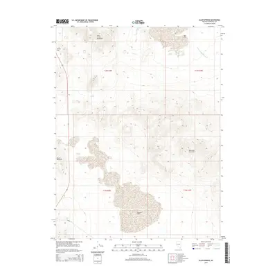
2014 Map of Allen Springs
USGS Topo · Published 2014About this map
White Throne Mountains and the Desert Mountains anchor this high-desert landscape in Churchill County, where thermal activity and arid terrain intersect. The map identifies several hydrologic features critical to this environment, including Lee Hot Springs and the aptly named Stinking Springs. These water sources, alongside Allen Springs, historically served as vital points for travelers crossing the Great Basin. To the east, the Blow Sand Mountains rise above the expansive Rawhide Flats, a name reflecting the region's connection to the era of silver and gold prospecting. Transportation through the area is marked by Rawhide Rd and the crossing at Russell Pass, while the drainage of Diamond Field Jack Wash cuts through the northeast, named for the infamous Idaho cowboy and gunman whose legend reached deep into the Nevada desert.
Find a feature on this map
14 named features on this map. Tap any name to fly to it.
Don’t see what you’re looking for? This feature index may not catch every label — zoom into the map to look around manually.
Map Details
Editions of this 2014 Allen Springs Map
This is the sole edition of this map. No revisions or reprints were ever made.
Other maps of this area

1908 · Carson Sink
USGS Topo · 1:250,000

1910 · Carson Sink
USGS Topo · 1:250,000

1951 · Carson Lake
USGS Topo · 1:62,500

1951 · Allen Springs
USGS Topo · 1:62,500

1951 · Weber Reservoir
USGS Topo · 1:62,500

1951 · Fallon
USGS Topo · 1:62,500

1957 · Reno
USGS Topo · 1:250,000

1959 · Reno
USGS Topo · 1:250,000

1960 · Reno
USGS Topo · 1:250,000

1979 · Fallon
USGS Topo · 1:100,000