
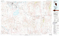
1979 Map of Fallon
USGS Topo · Published 1980About this map
The Lahontan Valley serves as a stark geographic anchor in this western Nevada landscape, where the agricultural hub of Fallon transitions into the expansive U.S. Naval Reservation. This late-1970s survey documents a region defined by its water management and military presence, from the Stillwater National Wildlife Refuge to the critical infrastructure of the Fallon Naval Air Station.
Find a feature on this map
109 named features on this map. Tap any name to fly to it.
Don’t see what you’re looking for? This feature index may not catch every label — zoom into the map to look around manually.
Map Details
Editions of this 1979 Fallon Map
2 editions found
Other maps of this area

1890 · Wadsworth
USGS Topo · 1:125,000

1891 · Wabuska
USGS Topo · 1:125,000

1891 · Wellington
USGS Topo · 1:125,000

1892 · Wadsworth
USGS Topo · 1:125,000

1893 · Wellington
USGS Topo · 1:125,000

1894 · Wadsworth
USGS Topo · 1:125,000

1894 · Wabuska
USGS Topo · 1:125,000

1907 · Tonopah
USGS Topo · 1:250,000

1908 · Tonopah
USGS Topo · 1:250,000

1908 · Carson Sink
USGS Topo · 1:250,000