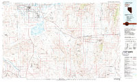
1979 Map of Fallon
USGS Topo · Published 1980About this map
The Fallon Naval Auxiliary Air Station and its expansive U S Naval Reservation dominate this high-desert landscape, illustrating the significant military footprint in Churchill County during the late 1970s. This region is a study in water management and reclamation, centered on the Carson River and its various distribution points, including the S Line Reservoir and the terminal waters of Carson Lake. To the northeast, the Stillwater National Wildlife Refuge provides a stark contrast to the surrounding arid basins like Rawhide Flats and the Salt Wells Basin. Industrial history is represented by remote mining sites such as the Black Eagle Mine and Broken Hills Mine. Small outposts like Frenchman and Middlegate serve as isolated markers along the thin lines of U.S. 50, while the city of Fallon stands as the primary hub of settlement amidst the desert mountains.
Find a feature on this map
46 named features on this map. Tap any name to fly to it.
Don’t see what you’re looking for? This feature index may not catch every label — zoom into the map to look around manually.
Map Details
Editions of this 1979 Fallon Map
2 editions found

Other maps of this area

1890 · Wadsworth
USGS Topo · 1:125,000

1891 · Wabuska
USGS Topo · 1:125,000

1891 · Wellington
USGS Topo · 1:125,000

1892 · Wadsworth
USGS Topo · 1:125,000

1893 · Wellington
USGS Topo · 1:125,000

1894 · Wadsworth
USGS Topo · 1:125,000

1894 · Wabuska
USGS Topo · 1:125,000

1907 · Tonopah
USGS Topo · 1:250,000

1908 · Tonopah
USGS Topo · 1:250,000

1908 · Carson Sink
USGS Topo · 1:250,000