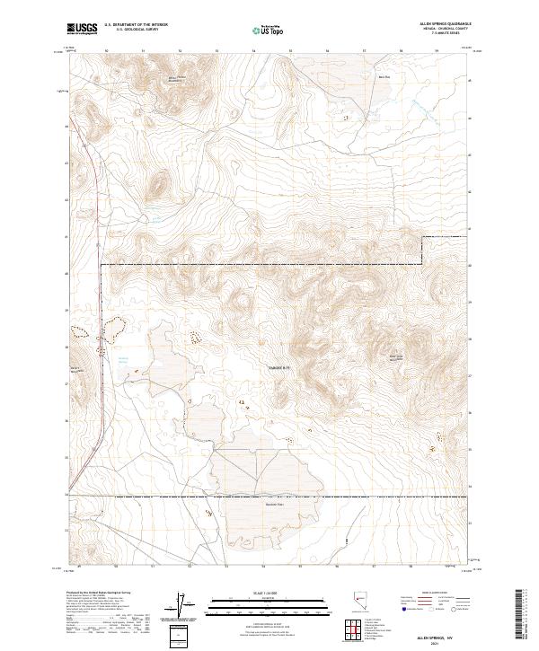
2021 Map of Allen Springs
USGS Topo · Published 2021About this map
Hydrological features define this arid Churchill County landscape, where groundwater emerges at distinct points across the Great Basin terrain. Allen Springs and Lee Hot Springs sit along the western slopes, providing critical water sources in a region dominated by the White Throne Mountains and the Desert Mountains. The presence of these named springs suggests the historical importance of reliable water for travelers and livestock moving through the basin-and-range topography.
Find a feature on this map
14 named features on this map. Tap any name to fly to it.
Don’t see what you’re looking for? This feature index may not catch every label — zoom into the map to look around manually.
Map Details
Editions of this 2021 Allen Springs Map
This is the sole edition of this map. No revisions or reprints were ever made.
Other maps of this area

1908 · Carson Sink
USGS Topo · 1:250,000

1910 · Carson Sink
USGS Topo · 1:250,000

1951 · Carson Lake
USGS Topo · 1:62,500

1951 · Allen Springs
USGS Topo · 1:62,500

1951 · Weber Reservoir
USGS Topo · 1:62,500

1951 · Fallon
USGS Topo · 1:62,500

1957 · Reno
USGS Topo · 1:250,000

1959 · Reno
USGS Topo · 1:250,000

1960 · Reno
USGS Topo · 1:250,000

1979 · Fallon
USGS Topo · 1:100,000