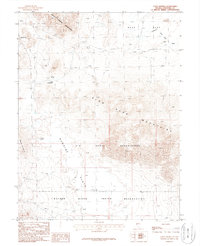
1987 Map of Allen Springs
USGS Topo · Published 1988About this map
Allen Springs and Lee Hot Springs serve as primary landmarks in this arid Nevada landscape, which is dominated by the overlapping boundaries of the U S Naval Reservation and the Walker River Indian Reservation. The geography is defined by terminal basins and prominent ranges, including the White Throne Mountains to the north and the Blow Sand Mountains to the east. Evidence of early mineral exploration is scattered throughout the hills, noted by several Prospects and a singular Mine Shaft. The presence of Alkali Flats and the uniquely named Stinking Springs underscores the geothermal and evaporative nature of this high desert terrain in the late 20th century. High-voltage Trans Lines and 4WD tracks represent the limited modern infrastructure crossing through Russell Pass.
Find a feature on this map
26 named features on this map. Tap any name to fly to it.
Don’t see what you’re looking for? This feature index may not catch every label — zoom into the map to look around manually.
Map Details
Editions of this 1987 Allen Springs Map
This is the sole edition of this map. No revisions or reprints were ever made.
Other maps of this area

1908 · Carson Sink
USGS Topo · 1:250,000

1910 · Carson Sink
USGS Topo · 1:250,000

1951 · Carson Lake
USGS Topo · 1:62,500

1951 · Allen Springs
USGS Topo · 1:62,500

1951 · Weber Reservoir
USGS Topo · 1:62,500

1951 · Fallon
USGS Topo · 1:62,500

1957 · Reno
USGS Topo · 1:250,000

1959 · Reno
USGS Topo · 1:250,000

1960 · Reno
USGS Topo · 1:250,000

1979 · Fallon
USGS Topo · 1:100,000