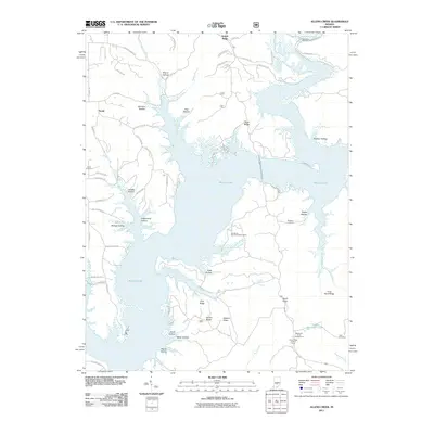
2011 Map of Allens Creek
USGS Topo · Published 2011About this map
Monroe Lake dominates this central Indiana landscape, its sprawling waters filling the valleys between a complex system of ridges and hollows. The terrain is defined by prominent elevations such as Knight Ridge, Rush Ridge, and Hardin Ridge, which separate deep drainages including Allens Creek and Moore Creek. The irregular shoreline created by these ridges provides a distinct geographical character, where land-based activities and water-focused recreation meet at sites like the Ransburg Boy Scout Reservation.
Find a feature on this map
70 named features on this map. Tap any name to fly to it.
Don’t see what you’re looking for? This feature index may not catch every label — zoom into the map to look around manually.
Map Details
Editions of this 2011 Allens Creek Map
This is the sole edition of this map. No revisions or reprints were ever made.
Other maps of this area

1908 · Bloomington
USGS Topo · 1:48,000

1910 · Bloomington
USGS Topo · 1:62,500

1934 · Bedford
USGS Topo · 1:48,000

1935 · Oolitic
USGS Topo · 1:48,000

1937 · Bedford
USGS Topo · 1:62,500

1942 · Franklin
USGS Topo · 1:125,000

1942 · Oolitic
USGS Topo · 1:62,500

1946 · Belmont
USGS Topo · 1:24,000

1947 · Allens Creek
USGS Topo · 1:24,000

1947 · Unionville
USGS Topo · 1:24,000