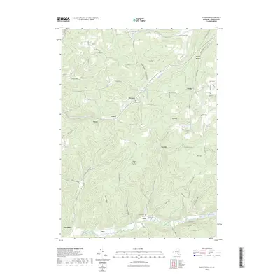
2023 Map of Allentown
USGS Topo · Published 2023About this map
Knight Creek and its many tributaries carve a complex network of narrow valleys through the Allegany County highlands, defining the settlement patterns of this New York landscape. Small hamlets like Allentown and Petrolia are situated along these watercourses, connected by winding routes such as Allentown Rd and Petrolia Rd. The terrain is characterized by steep-sided hollows, including California Hollow and Stoney Lonesome Hollow, which drain toward the larger valleys. Family history is anchored in several small burial grounds, notably Sunnyside Cem near Alma and the Allentown Cem. The high points of the region, such as Alma Hill and Norton Summit, overlook a landscape where agriculture and timber historically followed the creek beds while the ridge tops remained largely forested. This map provides a modern record of these long-established rural centers and their relationship to the dissected plateau topography of the Southern Tier.
Find a feature on this map
89 named features on this map. Tap any name to fly to it.
Don’t see what you’re looking for? This feature index may not catch every label — zoom into the map to look around manually.
Map Details
Editions of this 2023 Allentown Map
This is the sole edition of this map. No revisions or reprints were ever made.
Other maps of this area

1925 · Belmont
USGS Topo · 1:62,500

1926 · Wellsville
USGS Topo · 1:62,500

1932 · Genesee
USGS Topo · 1:62,500

1934 · Coudersport
USGS Topo · 1:48,000

1937 · Genesee
USGS Topo · 1:62,500

1938 · Coudersport
USGS Topo · 1:62,500

1939 · Belmont
USGS Topo · 1:62,500

1950 · Elmira
USGS Topo · 1:250,000

1954 · Williamsport
USGS Topo · 1:250,000

1957 · Warren
USGS Topo · 1:250,000