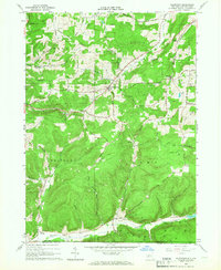
1965 Map of Allentown
USGS Topo · Published 1966About this map
Oil Wells pepper the landscape across the southern tier of Allegany County, marking a region defined by its long-standing petroleum extraction industry. Centered on Allentown, the terrain is a complex network of ridges and deep hollows like California Hollow and Stony Lonesome Hollow. The 1960s economy here appears deeply tied to these natural resources, with numerous drilling sites interspersed among established agricultural roads. Small hamlets such as Alma and Petrolia serve as local hubs along the winding valley floors.
Find a feature on this map
58 named features on this map. Tap any name to fly to it.
Don’t see what you’re looking for? This feature index may not catch every label — zoom into the map to look around manually.
Map Details
Editions of this 1965 Allentown Map
This is the sole edition of this map. No revisions or reprints were ever made.
Other maps of this area

1925 · Belmont
USGS Topo · 1:62,500

1926 · Wellsville
USGS Topo · 1:62,500

1932 · Genesee
USGS Topo · 1:62,500

1934 · Coudersport
USGS Topo · 1:48,000

1937 · Genesee
USGS Topo · 1:62,500

1938 · Coudersport
USGS Topo · 1:62,500

1939 · Belmont
USGS Topo · 1:62,500

1950 · Elmira
USGS Topo · 1:250,000

1954 · Williamsport
USGS Topo · 1:250,000

1957 · Warren
USGS Topo · 1:250,000